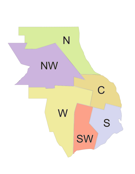
Image: Districts of Rosario (noted) (en)

Size of this PNG preview of this SVG file: 463 × 599 pixels. Other resolution: 185 × 240 pixels.
Original image (SVG file, nominally 765 × 990 pixels, file size: 19 KB)
Description: Districts of the municipality of Rosario, Argentina. Contour map, color-coded, noted with English initials for the district names: North, NorthWest, Center, West, SouthWest, South.
Title: Districts of Rosario (noted) (en)
Credit: Made it myself based on publicly available diagram at http://www.rosario.gov.ar
Author: Pablo D. Flores
Permission: Public domain (use it for any purpose whatsoever)
Usage Terms: Public domain
License: Public domain
Attribution Required?: No
Image usage
The following page links to this image:

All content from Kiddle encyclopedia articles (including the article images and facts) can be freely used under Attribution-ShareAlike license, unless stated otherwise.
