
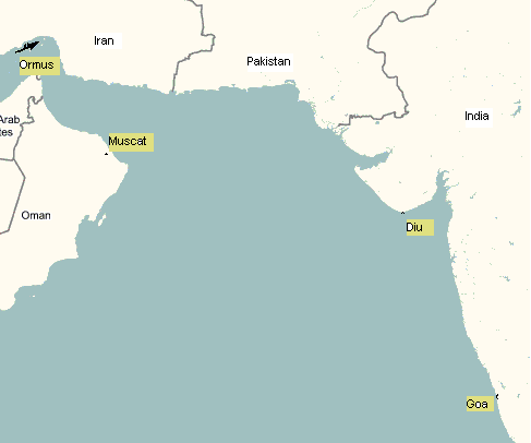
Image: Diu Map
No higher resolution available.
Diu_Map.gif (487 × 406 pixels, file size: 7 KB, MIME type: image/gif)
Description: Map showing various Portuguese Indian Ocean domains around the early 16th century.
Title: Diu Map
Credit: Diagram/Map created by uploader.
Author: Diagram: Mkamat (talk) (Uploads), Base Map:?
Usage Terms: Public domain
License: PD
Attribution Required?: No
Image usage
The following page links to this image:

All content from Kiddle encyclopedia articles (including the article images and facts) can be freely used under Attribution-ShareAlike license, unless stated otherwise.