
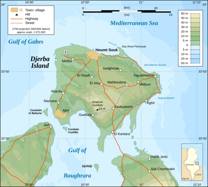
Image: Djerba topographic map-en

Size of this PNG preview of this SVG file: 666 × 599 pixels. Other resolution: 267 × 240 pixels.
Original image (SVG file, nominally 1,100 × 990 pixels, file size: 564 KB)
Description: Topographic map in French of Djerba Island, Tunisia. Commons page: Djerba (island). Note: The shaded relief is a raster image embedded in the SVG file.
Title: Djerba topographic map-en
Credit: Djerba_topographic_map-fr.svg
Author: Djerba_topographic_map-fr.svg: Eric Gaba (Sting - fr:Sting) derivative work: Morn (talk)
Usage Terms: Creative Commons Attribution-Share Alike 3.0
License: CC BY-SA 3.0
License Link: https://creativecommons.org/licenses/by-sa/3.0
Attribution Required?: Yes
Image usage
The following page links to this image:

All content from Kiddle encyclopedia articles (including the article images and facts) can be freely used under Attribution-ShareAlike license, unless stated otherwise.