
Image: Donaldsonville I Battlefield Louisiana
Size of this preview: 784 × 600 pixels. Other resolutions: 314 × 240 pixels | 1,360 × 1,040 pixels.
Original image (1,360 × 1,040 pixels, file size: 457 KB, MIME type: image/jpeg)
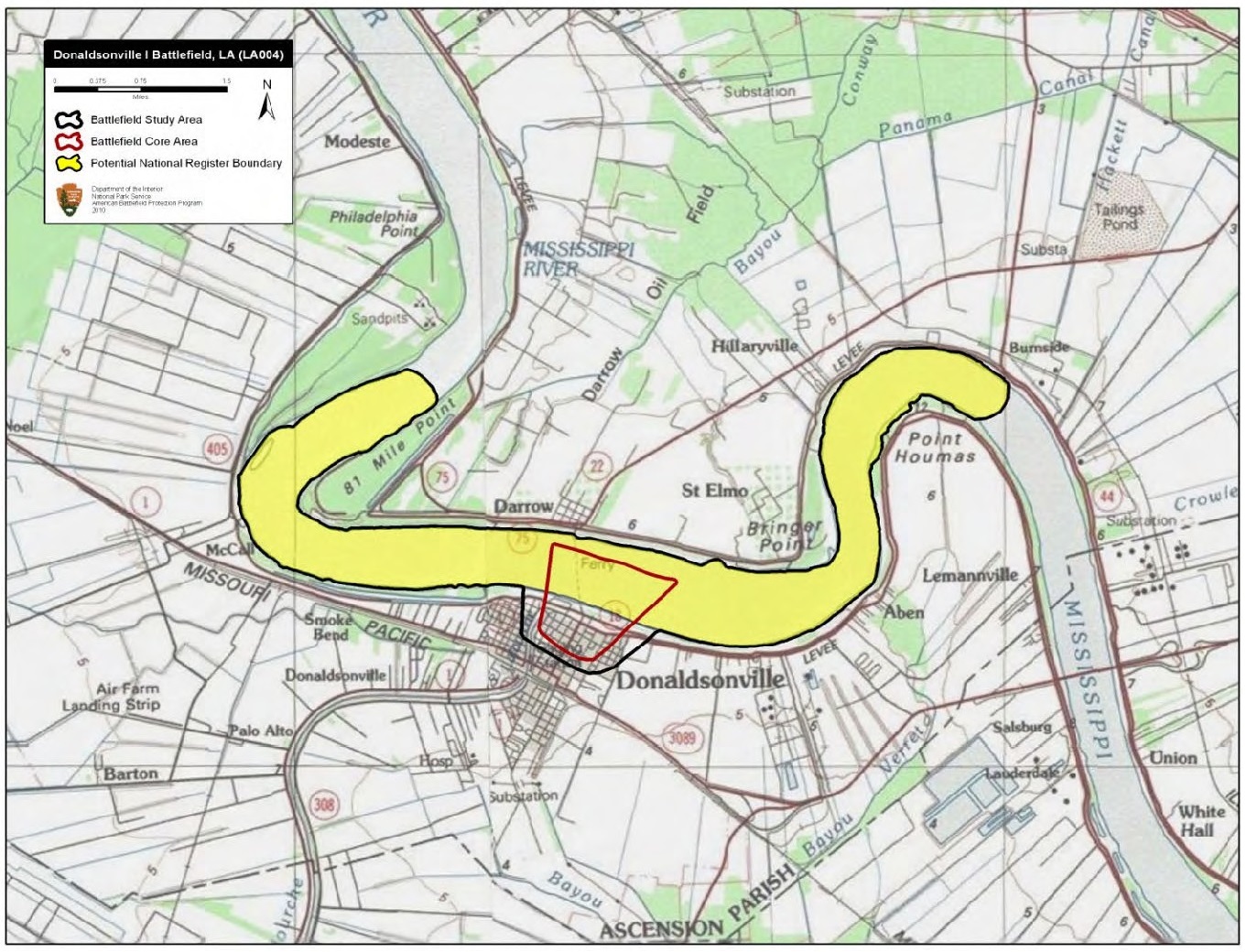
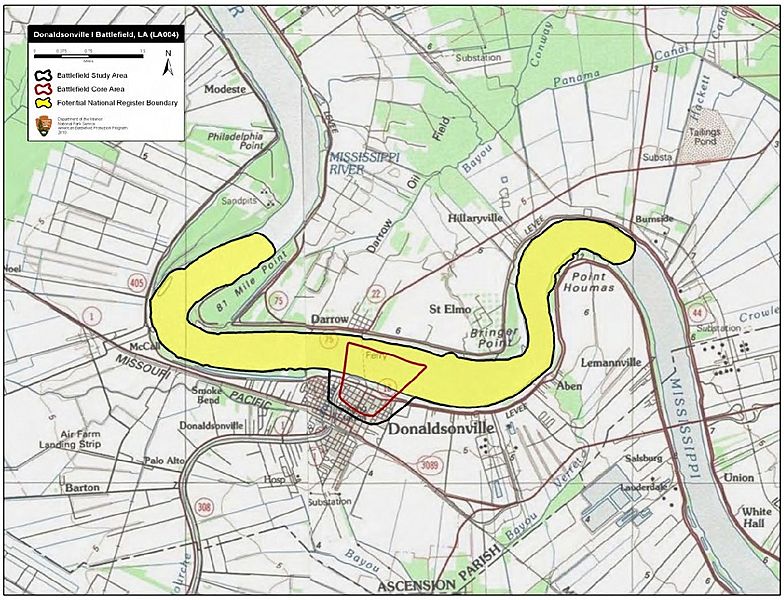
Description: Map of battlefield core and study areas. The revised Study Area illustrates the Federal squadron’s movements north of Donaldsonville as it prepared to shell the town, and the squadron’s subsequent movement away from the town. The Core Area was widened slightly to accommodate the size of the flotilla.
Title: Donaldsonville I Battlefield Louisiana
Credit: National Park Service
Author: American Battlefield Protection Program
Usage Terms: Public domain
License: Public domain
Attribution Required?: No
Image usage
The following page links to this image:

All content from Kiddle encyclopedia articles (including the article images and facts) can be freely used under Attribution-ShareAlike license, unless stated otherwise.