
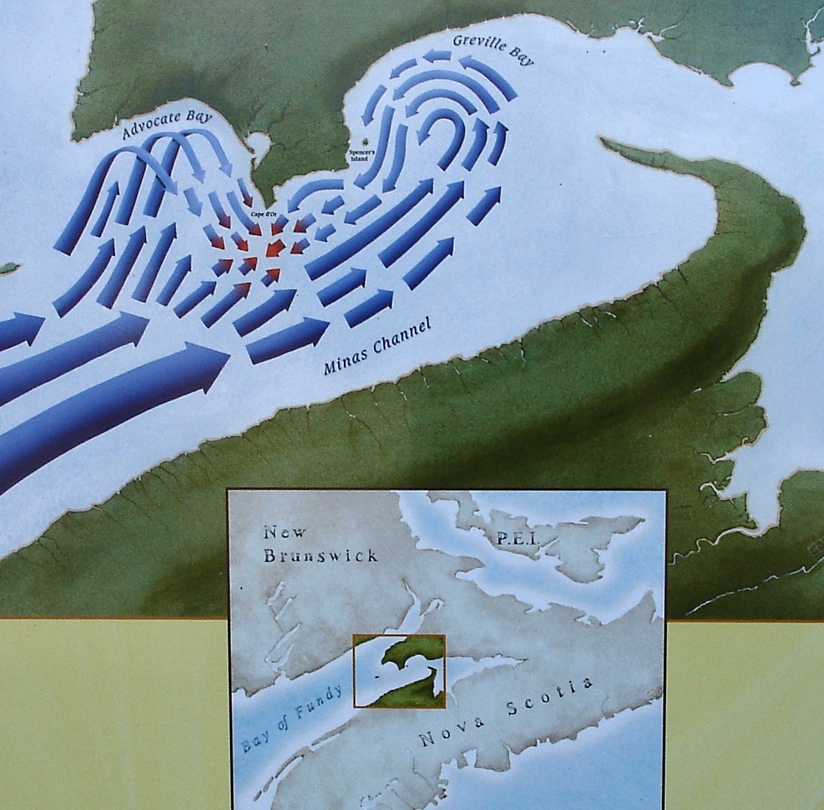
Image: Dory Rips diagram in govt parking lot at Cape d Or lookout Nova Scotia Canada 2007
Size of this preview: 609 × 599 pixels. Other resolutions: 244 × 240 pixels | 1,174 × 1,155 pixels.
Original image (1,174 × 1,155 pixels, file size: 709 KB, MIME type: image/jpeg)
Description: image of sign posted in govt parking lot at Cape d'Or, Nova Scotia, Canada, showing how tidal flow creates Dory rip currents off the coast of Cape d'Or.
Title: Dory Rips diagram in govt parking lot at Cape d Or lookout Nova Scotia Canada 2007
Credit: Own work
Author: WikiPedant
Usage Terms: Creative Commons Attribution-Share Alike 4.0
License: CC BY-SA 4.0
License Link: https://creativecommons.org/licenses/by-sa/4.0
Attribution Required?: Yes
Image usage
The following page links to this image:

All content from Kiddle encyclopedia articles (including the article images and facts) can be freely used under Attribution-ShareAlike license, unless stated otherwise.