
Image: Drawing of Summit Springs battleground - DPLA - 51a802cd566b0d245a34a481f67b571e
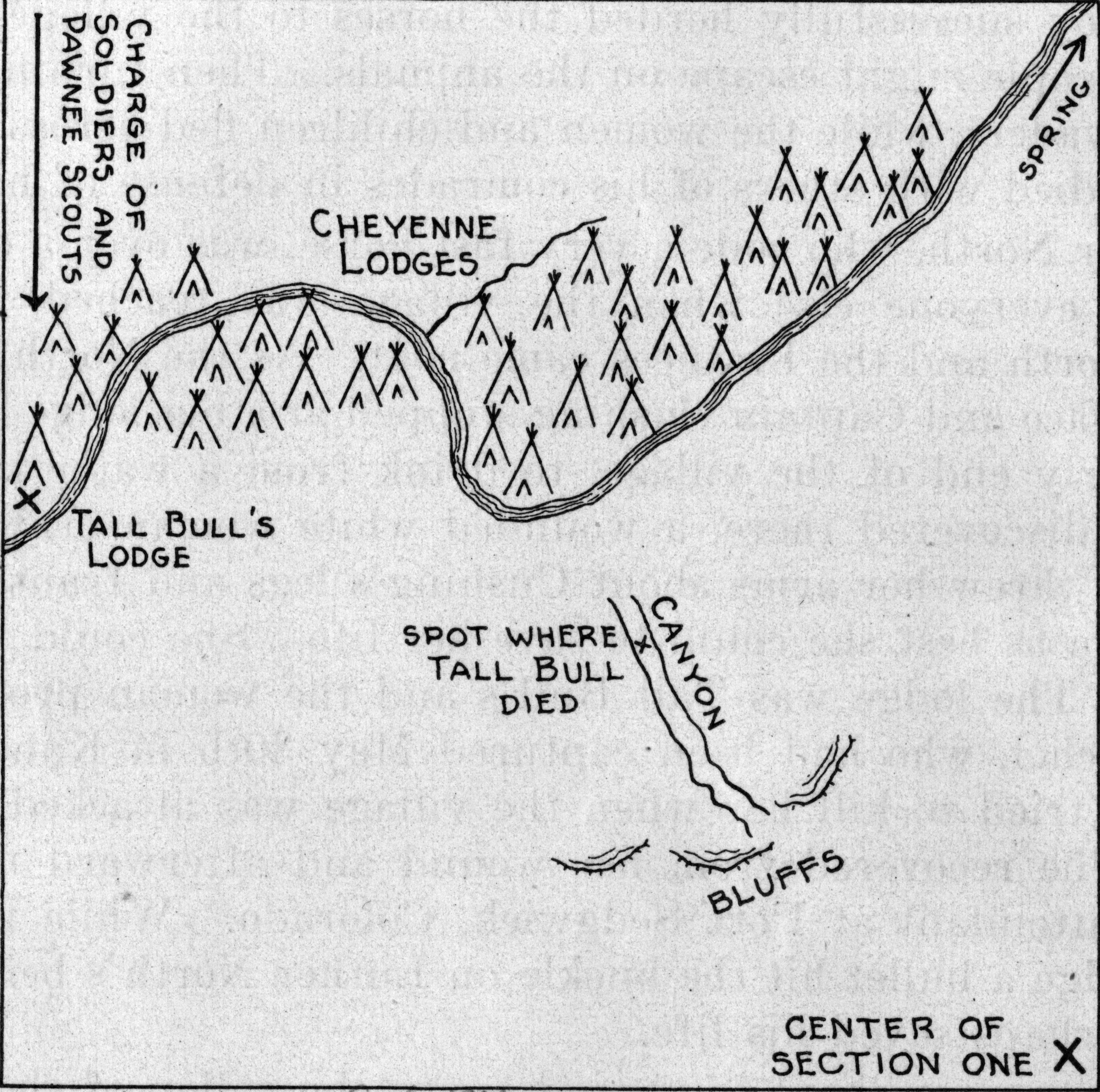
Description: A map of the area where the Battle of Summit Springs (1869) in Colorado took place. Included are the placements of Native American (Cheyenne) tepees along the stream, the direction from whence came the attack by soldiers and Pawnee scouts, the location of Tall Bull's tepee and place of his death in a canyon, and the bluffs above the canyon.
Title: Drawing of Summit Springs battleground
Credit: This file was contributed to Wikimedia Commons by Denver Public Library as part of a cooperation project. The donation was facilitated by the Digital Public Library of America, via its partner Plains to Peaks Collective. Record in source catalog DPLA identifier: 51a802cd566b0d245a34a481f67b571e
Permission: This image might not be in the public domain outside of the United States; this especially applies in the countries and areas that do not apply the rule of the shorter term for US works, such as Canada, Mainland China (not Hong Kong or Macao), Germany, Mexico, and Switzerland. The creator and year of publication are essential information and must be provided. See Wikipedia:Public domain and Wikipedia:Copyrights for more details.
Usage Terms: Public domain
License: Public domain
Attribution Required?: No
Image usage
The following page links to this image:
