
Image: DraytonMapOfNinetySix
No higher resolution available.
DraytonMapOfNinetySix.png (764 × 430 pixels, file size: 20 KB, MIME type: image/png)
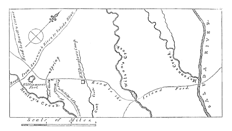
Description: Map showing the area around Ninety Six, South Carolina early in the American Revolutionary War. The "fort" of Major Andrew Williamson, the site of the Siege of Savage's Old Fields is visible.
Title: DraytonMapOfNinetySix
Credit: Memoirs of the American Revolution: https://books.google.com/books?id=L1CEdG_zLtYC&lpg=PP1&dq=editions%3A5FAX6GilmhAC&pg=PA389-IA1#v=onepage&q=editions:5FAX6GilmhAC&f=false
Author: Map author unknown
Usage Terms: Public domain
License: Public domain
Attribution Required?: No
Image usage
The following page links to this image:

All content from Kiddle encyclopedia articles (including the article images and facts) can be freely used under Attribution-ShareAlike license, unless stated otherwise.