
Image: Drewry's Bluff Battlefield Virginia
Size of this preview: 790 × 600 pixels. Other resolutions: 316 × 240 pixels | 1,580 × 1,200 pixels.
Original image (1,580 × 1,200 pixels, file size: 1.08 MB, MIME type: image/jpeg)
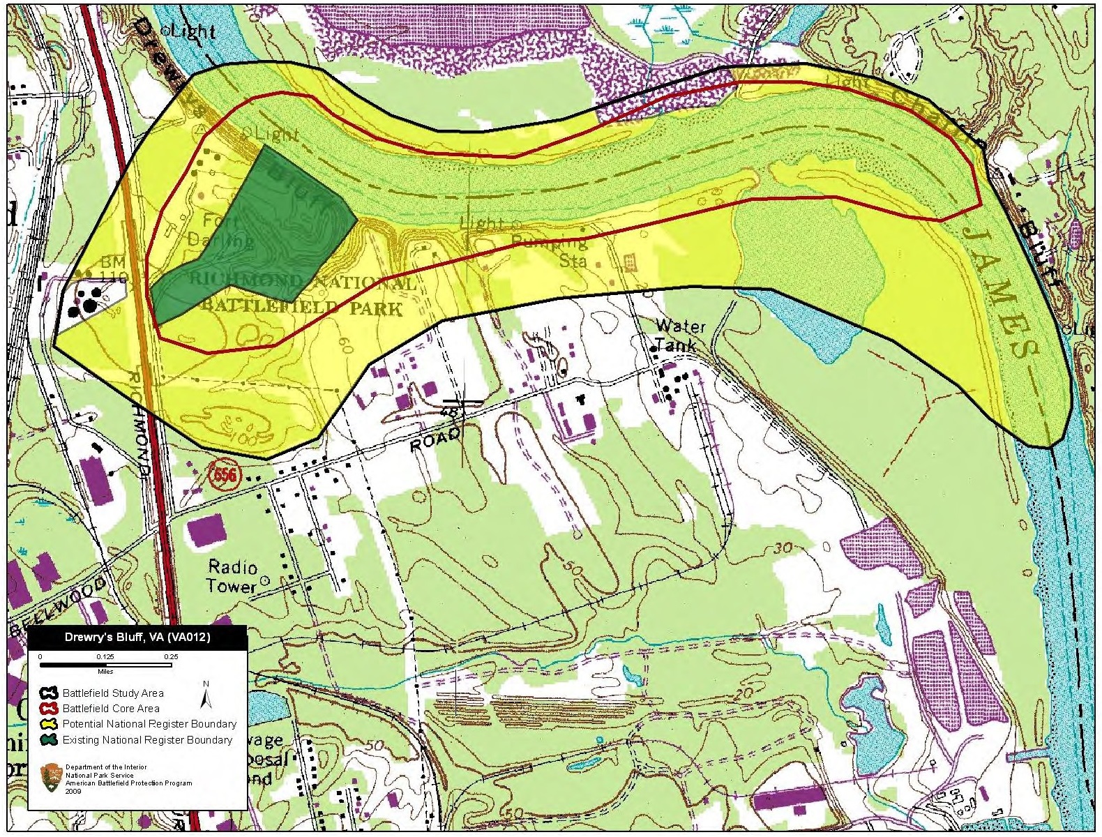
Description: Map of battlefield core and study areas. The CWSAC boundary incorrectly identified actions and lands on the south side of the James River as associated with the May 15, 1862, US naval attack on the CSA fortifications at Drewry’s Bluff. The revised Study Area is limited to the portion of the works and troop positions on the bluffs, and the stretch of river within accurate range of the Confederate guns where the Federal flotilla maneuvered and anchored during the engagement.
Title: Drewry's Bluff Battlefield Virginia
Credit: National Park Service
Author: American Battlefield Protection Program
Usage Terms: Public domain
License: Public domain
Attribution Required?: No
Image usage
The following page links to this image:

All content from Kiddle encyclopedia articles (including the article images and facts) can be freely used under Attribution-ShareAlike license, unless stated otherwise.