
Image: DuFief Mill-Travilah-C&O
No higher resolution available.
DuFief_Mill-Travilah-C&O.png (749 × 600 pixels, file size: 50 KB, MIME type: image/png)
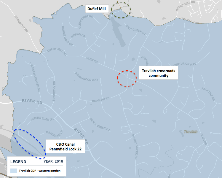
Description: Map of western portion of Travilah CDP showing former DuFief Mill, Travilah community, and Lock 22 of C&O Canal. Both the mill and canal lock were less than two miles from Travilah. Travilah was a small crossroads community that existed in the late 1800s and early 1900s.
Title: DuFief Mill-Travilah-C&O
Credit: This map came from the U.S. Census Bureau and has been modified by TwoScarsUp.
Author: U.S. Census Bureau and TwoScarsUp
Usage Terms: Public domain
License: Public domain
Attribution Required?: No
Image usage
The following page links to this image:

All content from Kiddle encyclopedia articles (including the article images and facts) can be freely used under Attribution-ShareAlike license, unless stated otherwise.