
Image: Dublin900

Size of this PNG preview of this SVG file: 728 × 600 pixels. Other resolution: 291 × 240 pixels.
Original image (SVG file, nominally 3,526 × 2,906 pixels, file size: 246 KB)
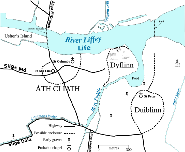
Description: SVG map of Dublin circa 900 CE - self-made after H. B. Clarke's maps of Dublin circa 840 and 1000 in Irish Historic Towns Atlas No. 11 (2002) and incorporating data from various archaeological studies.
Title: Dublin900
Credit: Own work
Author: Erigena
Usage Terms: Public domain
License: Public domain
Attribution Required?: No
Image usage
The following page links to this image:

All content from Kiddle encyclopedia articles (including the article images and facts) can be freely used under Attribution-ShareAlike license, unless stated otherwise.