
Image: Dudley
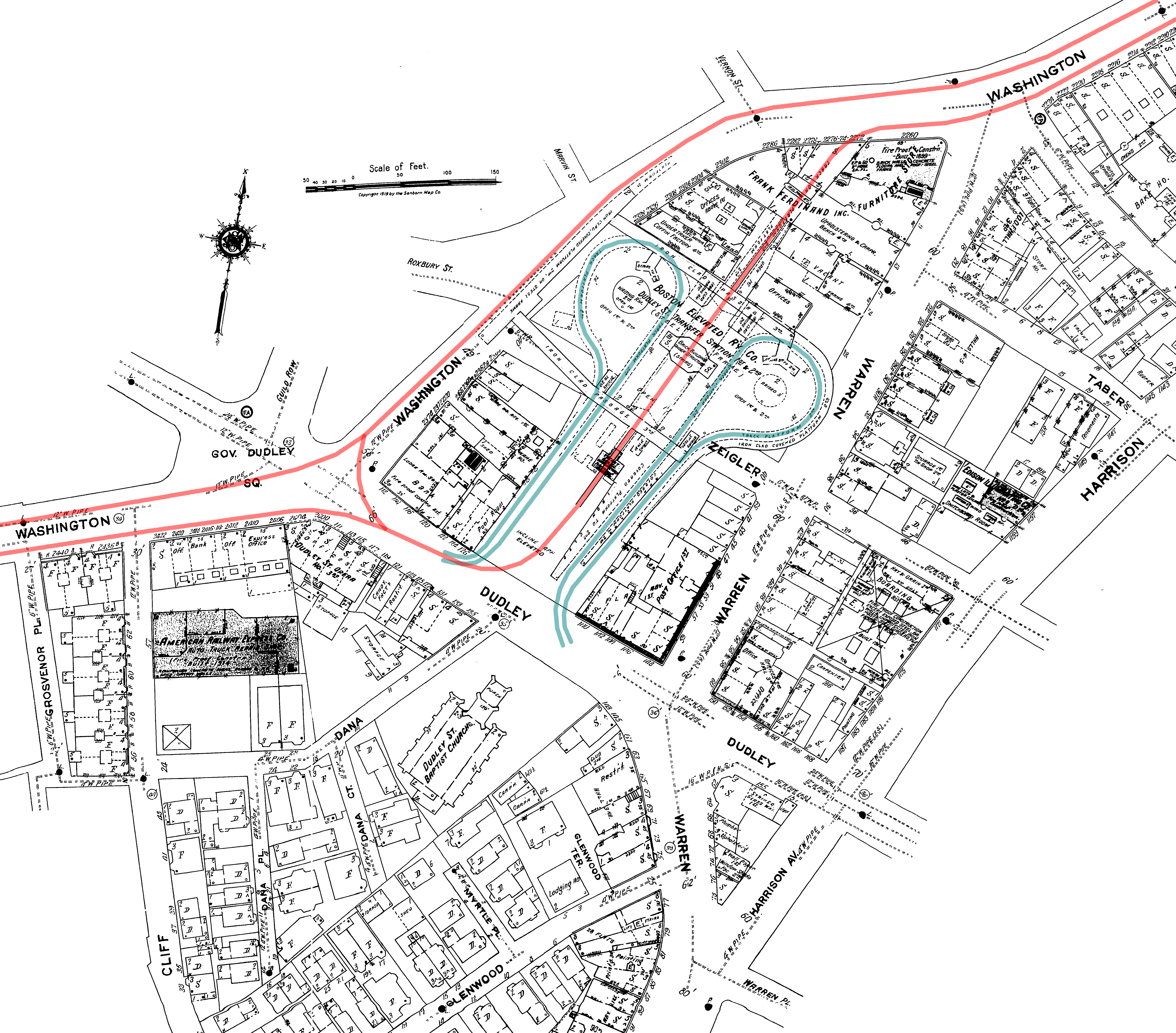
Description: Diagram of the old Dudley elevated station in Boston, accurate to the 1919 date of the base map. The Main Line Elevated (future Orange Line) tracks are in red, with the streetcar loops (later busways) in blue. Both are on the same level, with elevated walkways connecting the three platforms - two on the northbound Orange Line track and one southbound.
Title: Dudley upper 1919 map
Credit: Own work
Author: User:SPUI (overlay of Sanborn base map)
Permission: Public domainPublic domainfalsefalse This work has been released into the public domain by its author, SPUI. This applies worldwide. In some countries this may not be legally possible; if so: SPUI grants anyone the right to use this work for any purpose, without any conditions, unless such conditions are required by law.
Usage Terms: Public domain
License: Public domain
Attribution Required?: No
Image usage
The following page links to this image:
