
Image: EAC Zonenprotokoll 2

Size of this preview: 706 × 600 pixels. Other resolutions: 283 × 240 pixels | 2,362 × 2,006 pixels.
Original image (2,362 × 2,006 pixels, file size: 123 KB, MIME type: image/png)
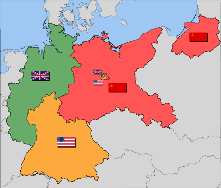
Description: Occupation zone borders in Germany, 1944.
Title: EAC Zonenprotokoll 2
Credit: Map-Germany-1947-2.png
Author: Map-Germany-1947-2.png: *_Map-Germany-1947.svg: User:52 Pickup derivative work: Yumyum73 (talk) derivative work: GEO (talk)
Usage Terms: Creative Commons Attribution-Share Alike 2.5
License: CC BY-SA 2.5
License Link: https://creativecommons.org/licenses/by-sa/2.5
Attribution Required?: Yes
Image usage
The following 2 pages link to this image:

All content from Kiddle encyclopedia articles (including the article images and facts) can be freely used under Attribution-ShareAlike license, unless stated otherwise.