
Image: Eagle Street Fig Trees, Information Plaque
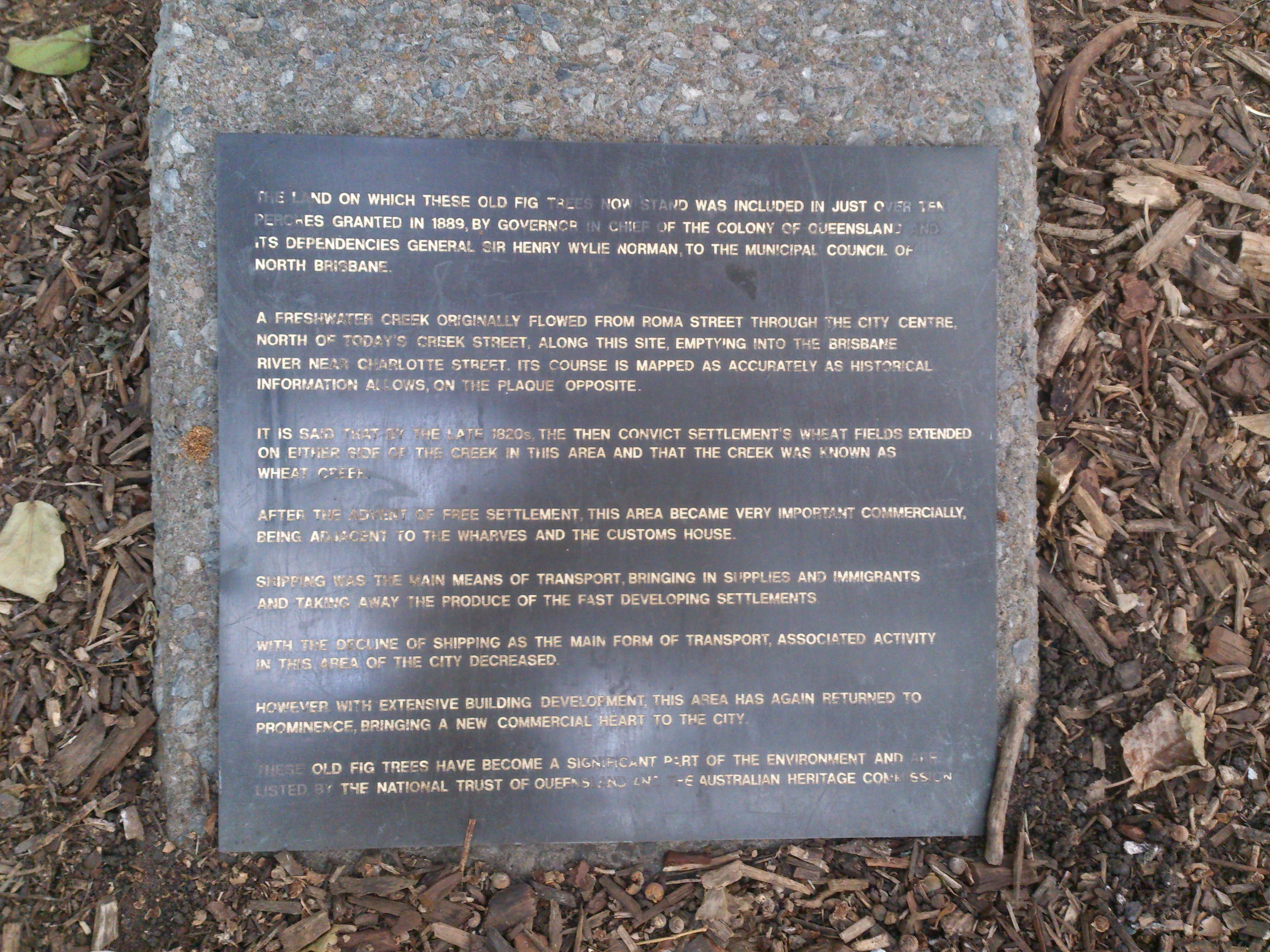
Description: The land on which these old fig trees now stand was included in just over ten perches granted in 1889, by governor in chief of the colony of Queensland and its dependencies General Sir Henry Wylie Norman, to the the municipal council of North Brisbane.A freshwater creek originally flowed from Roma Street through the city centre, north of today's Creek Street, along this site, emptying into the Brisbane River near Charlotte Street. Its course is mapped as accurately as historical information allows, on the plaque opposite.It is said that by the late 1820s, the then convict settlement's wheat fields extended on either side of the creek in this area and that the creek was known as wheat creek.After the advent of free settlement, this area became very important commercially, being adjacent to the wharves and the customs house.Shipping was the main means of transport, bringing in supplies and immigrants and taking away the produce of the fast developing settlements.With the decline of shipping as the main form of transport, associated activity in this area of the city decreased.However with extensive building development, this area has again returned to prominence, bringing a new commercial heart to the city.These old fig trees have become a significant part of the environment and are listed by the nation trust of queens and the Australian Heritage Commission.
Title: Eagle Street Fig Trees, Information Plaque
Credit: Own work
Author: Reubot
Usage Terms: Creative Commons Attribution-Share Alike 4.0
License: CC BY-SA 4.0
License Link: https://creativecommons.org/licenses/by-sa/4.0
Attribution Required?: Yes
Image usage
The following page links to this image:
