
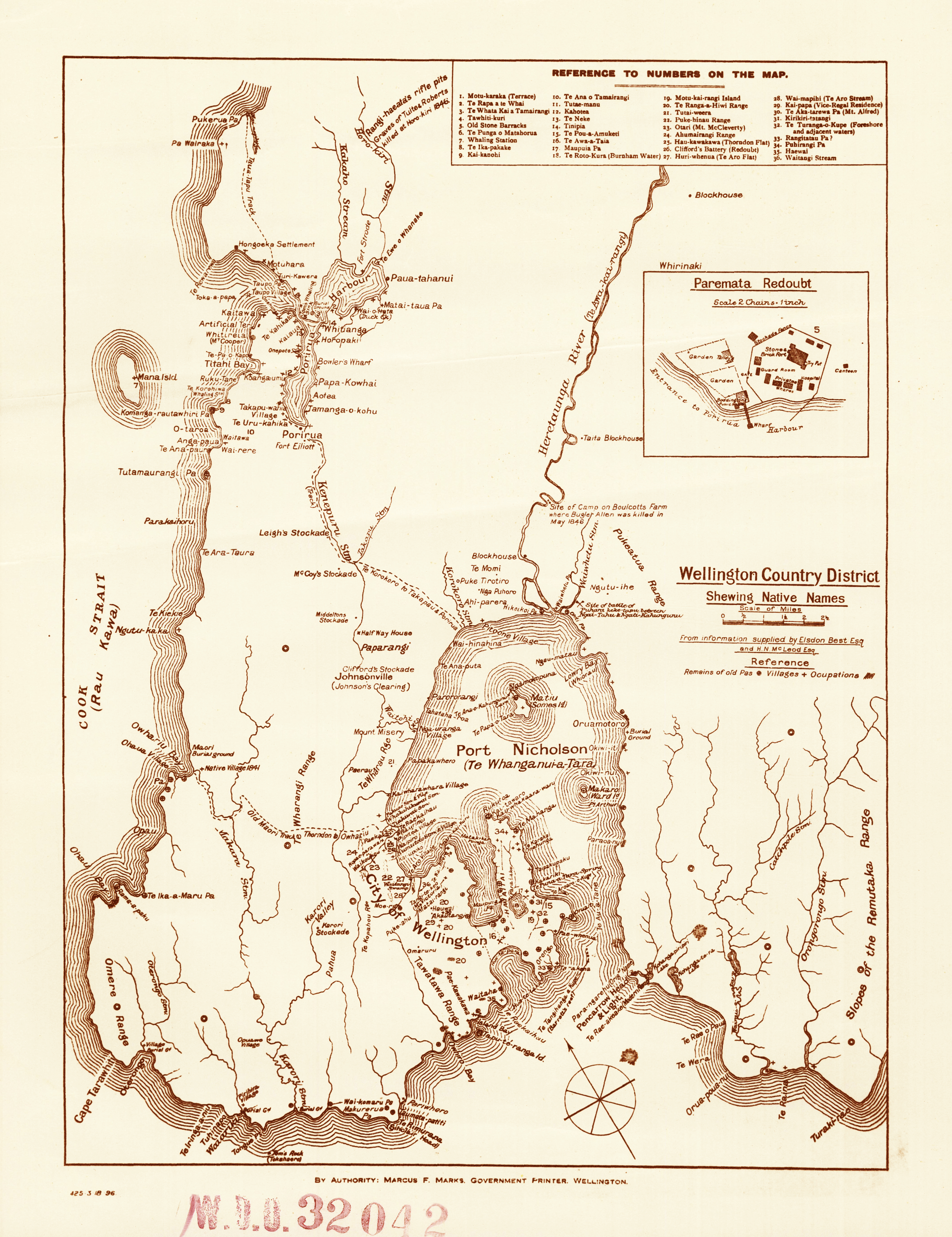
Image: Early Map of Wellington - Wellington County District (23530307892)
Description: This early map of Wellington County District shows a number of important historical sites, including Māori pā, pathways, wāhi tapu, and pre-1840 battle sites, as well as battle sites from the New Zealand Land Wars. A detail of Paremata Redoubt is also shown.
The map comes from a folder of Public Works maps of early Wellington (mainly copies rather than originals).
Archives Reference: AAOD W3273 Box 26/ WDO 32042 archway.archives.govt.nz/ViewFullItem.do?code=18059704
Material from Archives New Zealand
Author: Archives New Zealand from New Zealand
Usage Terms: Creative Commons Attribution-Share Alike 3.0
License: CC-BY-SA-3.0
License Link: http://creativecommons.org/licenses/by-sa/3.0/
Attribution Required?: Yes
Image usage
The following page links to this image:

.jpg)