
Image: East Portland Grand Avenue HD boundary map
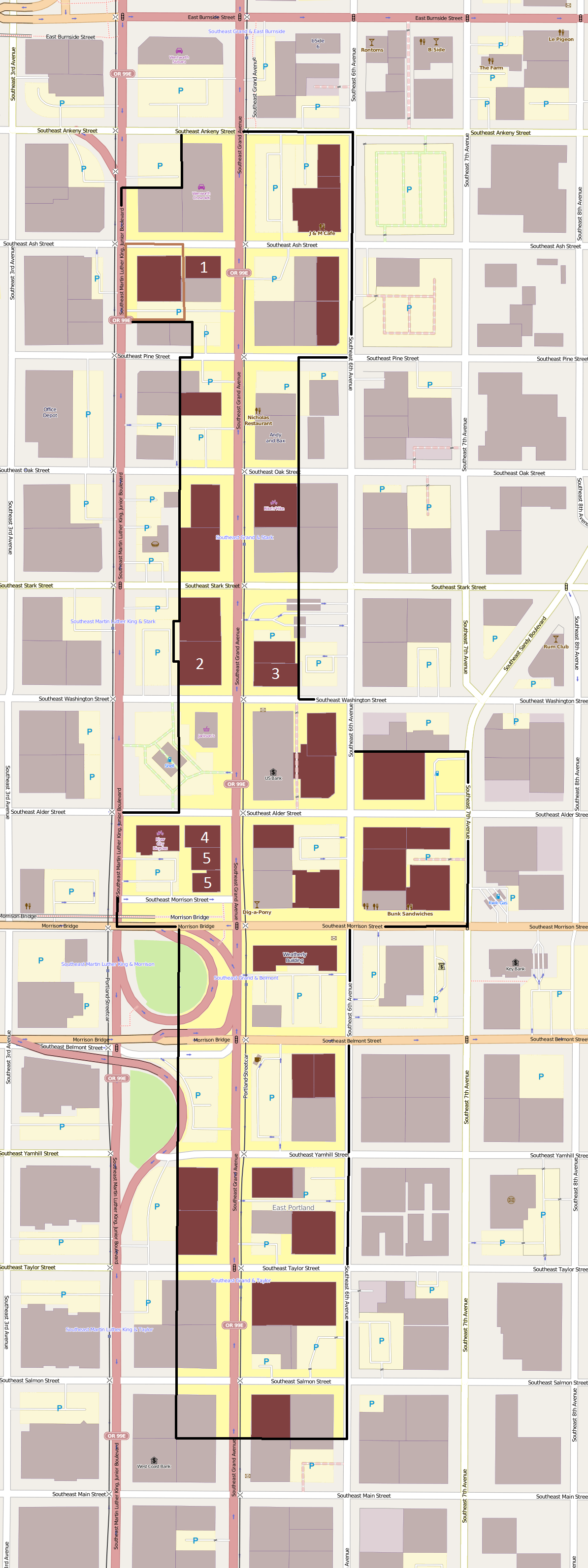
Description: Map showing the boundaries of the East Portland Grand Avenue Historic District in Portland, Oregon, United States. The historic district is listed on the US National Register of Historic Places. Data regarding boundaries and contributing properties are derived from the historic district's original National Register nomination form (1990) and nomination form to expand the district (2013). Black boundary/yellow area: East Portland Grand Avenue Historic District boundaries. Brown boundary: Area of the 2013 expansion of the historic district. Maroon shading: Buildings listed as contributing resources in the East Portland Grand Avenue Historic District. White numbers: Represent the locations of contributing resources in the historic district that are also listed individually on the National Register: Osborn Hotel New Logus Block Barber Block West's Block Nathaniel West Buildings
Title: East Portland Grand Avenue HD boundary map
Credit: Exported screenshot from OpenStreetMap, with district boundaries and shading and some titles drawn by uploader.
Author: Base map: OpenStreetMap contributors District boundaries/shading: Ian Poellet (User:Ipoellet)
Permission: Base map: © OpenStreetMap contributors. Current license information available at http://www.openstreetmap.org/copyright.
Usage Terms: Creative Commons Attribution-Share Alike 2.0
License: CC BY-SA 2.0
License Link: https://creativecommons.org/licenses/by-sa/2.0
Attribution Required?: Yes
Image usage
The following page links to this image:
