
Image: Ecuador DMZ EN

Size of this preview: 442 × 600 pixels. Other resolutions: 177 × 240 pixels | 1,404 × 1,905 pixels.
Original image (1,404 × 1,905 pixels, file size: 74 KB, MIME type: image/png)
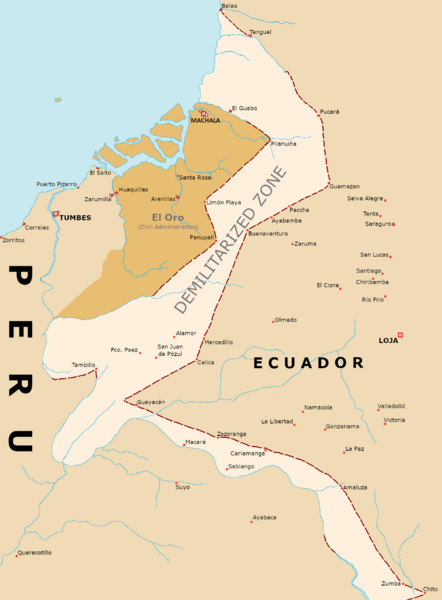
Description: English language map of the DMZ put in place in Ecuador from 1941 to 1942, as per the Talara Agreement of 2 October 1941. Also included is the occupation administration in El Oro after the implementation of the DMZ, including the province's de-facto border with Peru taking into consideration the border outposts set up by each country.
Title: Ecuador DMZ EN
Credit: Own work
Author: AlejandroFC
Usage Terms: Creative Commons Attribution-Share Alike 4.0
License: CC BY-SA 4.0
License Link: https://creativecommons.org/licenses/by-sa/4.0
Attribution Required?: Yes
Image usage
The following page links to this image:

All content from Kiddle encyclopedia articles (including the article images and facts) can be freely used under Attribution-ShareAlike license, unless stated otherwise.