
Image: Egypt and Syria 1768 to 1774 map en
Size of this preview: 771 × 600 pixels. Other resolutions: 309 × 240 pixels | 2,792 × 2,172 pixels.
Original image (2,792 × 2,172 pixels, file size: 264 KB, MIME type: image/png)
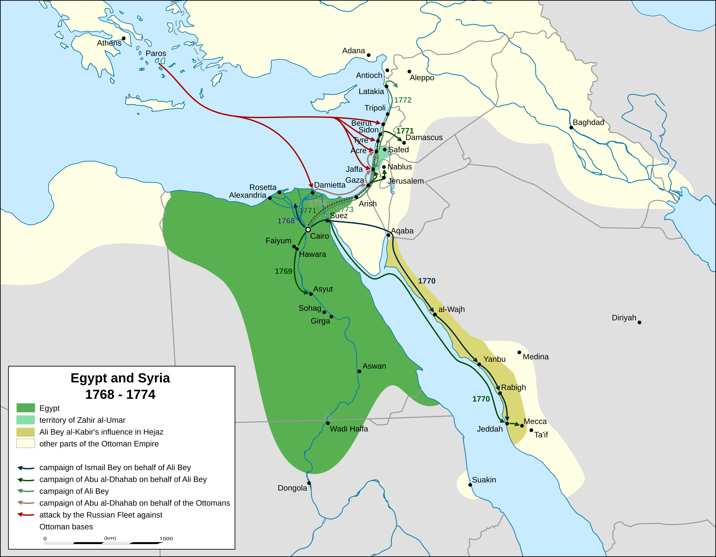
Description: map of mamluk egypt, palestine and syria 1768 to 1774. campaigns and advances according to Sauveur Lusignan: A history of the Revolution of Ali Bey against the Ottoman Porte (London 1783) and Meyers Konversationslexikon, vol. 1, page 359 (Leipzig, 4th edition, 1885-1892)
Title: Egypt and Syria 1768 to 1774 map en
Credit: Own work, derivat of File:Africa location map.svg
Author: Don-kun, Eric Gaba (Sting - fr:Sting)
Usage Terms: Creative Commons Attribution-Share Alike 3.0
License: CC BY-SA 3.0
License Link: https://creativecommons.org/licenses/by-sa/3.0
Attribution Required?: Yes
Image usage
The following page links to this image:

All content from Kiddle encyclopedia articles (including the article images and facts) can be freely used under Attribution-ShareAlike license, unless stated otherwise.