
Image: EisrandlagenNorddeutschland
No higher resolution available.
EisrandlagenNorddeutschland.png (474 × 405 pixels, file size: 349 KB, MIME type: image/png)
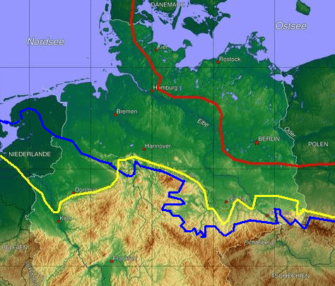
Description: Ice age map of europe, red: maximum limit of Weichselian ice age, yellow Saale-ice age at maximum (Drenthe stage), blue Elster-ice age maximum glaciation.
Title: EisrandlagenNorddeutschland
Credit: Transferred from de.wikipedia to Commons.
Author: Botaurus at German Wikipedia
Usage Terms: Public domain
License: Public domain
Attribution Required?: No
Image usage
There are no pages that link to this image.

All content from Kiddle encyclopedia articles (including the article images and facts) can be freely used under Attribution-ShareAlike license, unless stated otherwise.