
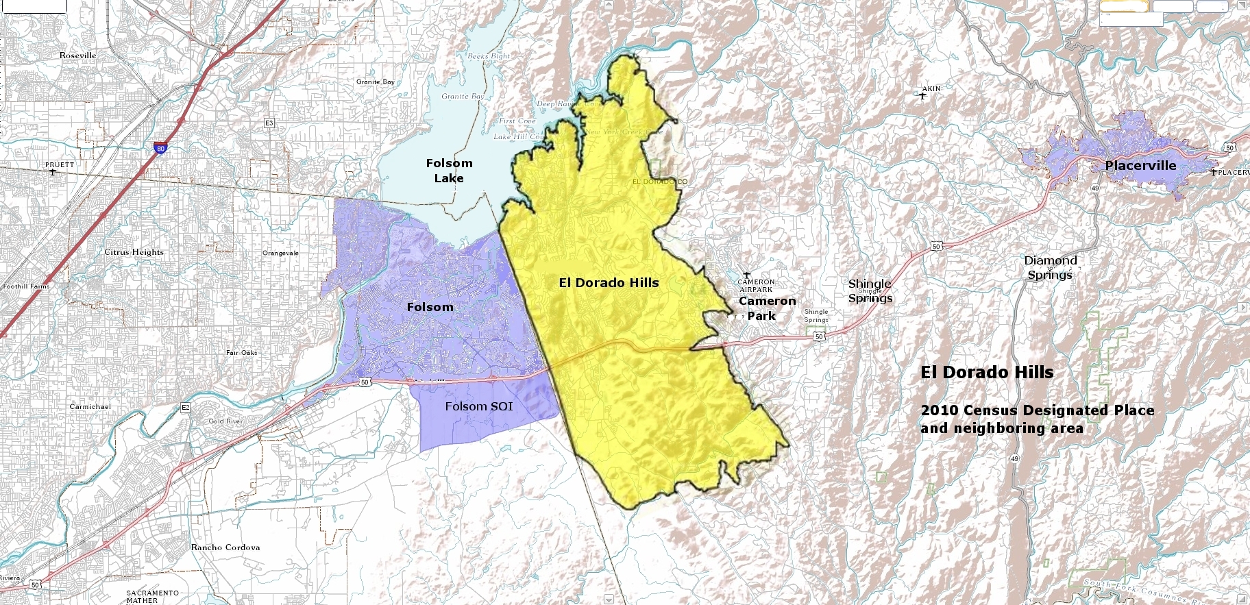
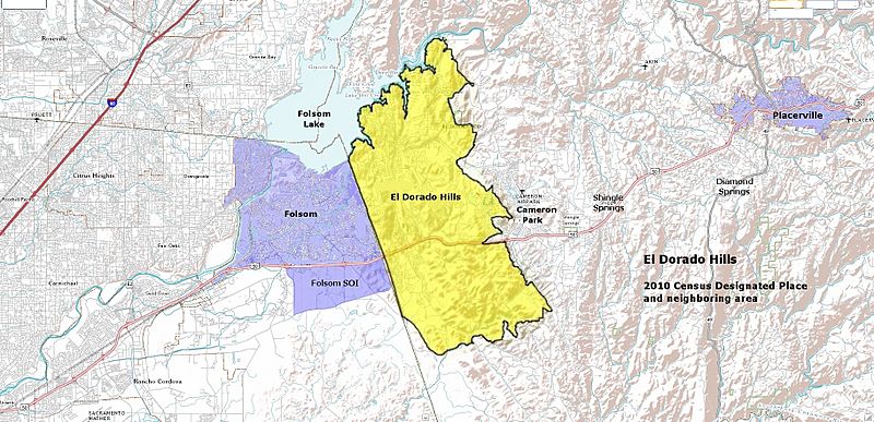
Image: El Dorado Hills CDP and region
Size of this preview: 800 × 387 pixels. Other resolutions: 320 × 155 pixels | 1,824 × 883 pixels.
Original image (1,824 × 883 pixels, file size: 1.44 MB, MIME type: image/jpeg)
Description: Map of the 2010 Census Designated Place for El Dorado Hills, overlayed onto a map from the USGS "The National Map" web source
Title: El Dorado Hills CDP and region
Credit: US Census Bureau, USGS, image fusion, shading, and annotation updated by me.
Author: US Census Bureau, USGS, Paul Raveling; Government sources supplied images in the public domain
Usage Terms: Public domain
License: Public domain
Attribution Required?: No
Image usage
There are no pages that link to this image.

All content from Kiddle encyclopedia articles (including the article images and facts) can be freely used under Attribution-ShareAlike license, unless stated otherwise.