
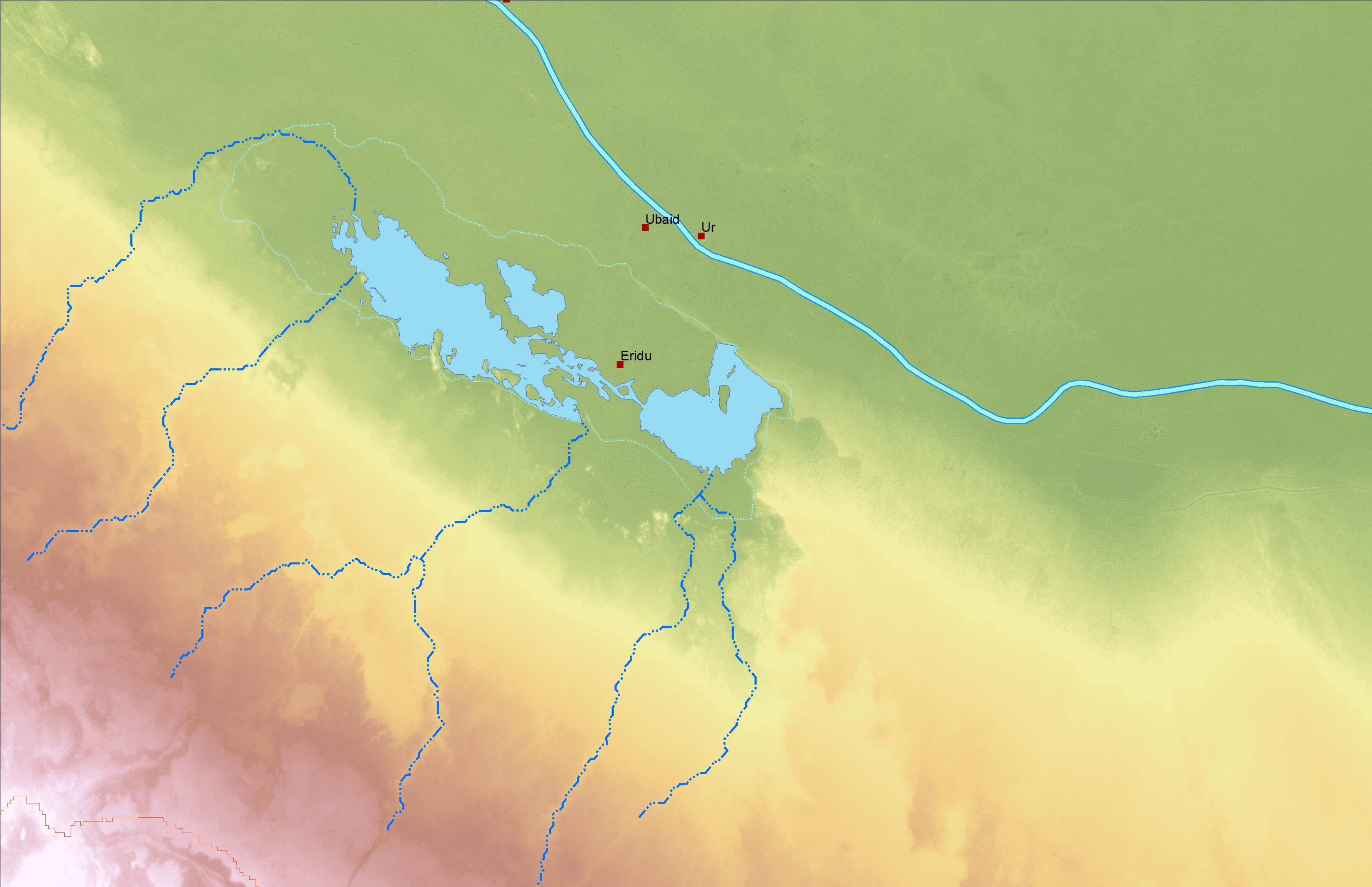
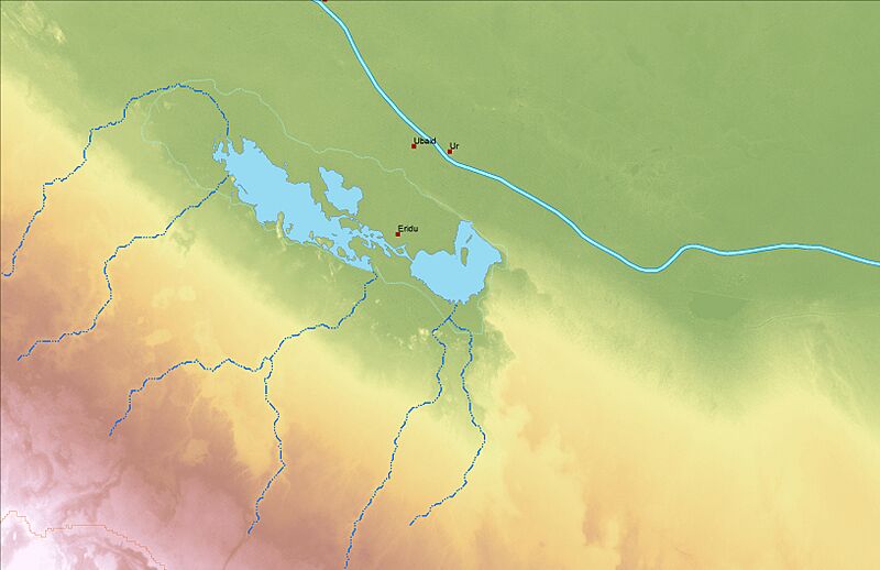
Image: Eridu Context Map
Size of this preview: 800 × 518 pixels. Other resolutions: 320 × 207 pixels | 3,264 × 2,112 pixels.
Original image (3,264 × 2,112 pixels, file size: 3.59 MB, MIME type: image/jpeg)
Description: I created this map in GIS using open source data. It shows the relationship of Eridu to other Sumerian cities, the Euphrates River at the time of 4000 BC. The seasonal lake is taken from Landsat data on June, 6, 2006 at highest water elevation. The normal water level is in a reservoir Hammar Lake).
Title: Eridu Context Map
Credit: Own work
Author: Gurdjieff
Usage Terms: Creative Commons Attribution-Share Alike 4.0
License: CC BY-SA 4.0
License Link: https://creativecommons.org/licenses/by-sa/4.0
Attribution Required?: Yes
Image usage
The following page links to this image:

All content from Kiddle encyclopedia articles (including the article images and facts) can be freely used under Attribution-ShareAlike license, unless stated otherwise.