
Image: Estuarial mudflats at Leigh-on-Sea - geograph.org.uk - 778899
No higher resolution available.
Estuarial_mudflats_at_Leigh-on-Sea_-_geograph.org.uk_-_778899.jpg (640 × 445 pixels, file size: 46 KB, MIME type: image/jpeg)
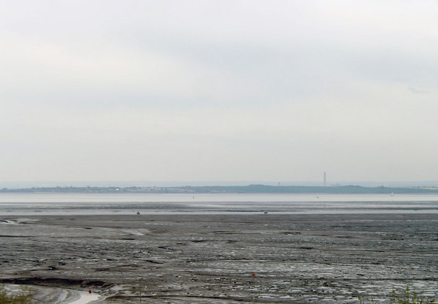
Description: Estuarial mudflats at Leigh-on-Sea Leigh Sand is the area of inter-tidal mudflat to the right of the creek that can be seen winding its way through the left of the image. The channel that runs across the centre of the image is Ray Gut and the area of mud between Ray Gut and the main course of the Thames is Chapman Sands. It is in the Benfleet and Southend Marshes Site of Special Scientific Interest.
Title: Estuarial mudflats at Leigh-on-Sea - geograph.org.uk - 778899
Credit: From geograph.org.uk
Author: David Kemp
Usage Terms: Creative Commons Attribution-Share Alike 2.0
License: CC BY-SA 2.0
License Link: https://creativecommons.org/licenses/by-sa/2.0
Attribution Required?: Yes
Image usage
The following 2 pages link to this image:

All content from Kiddle encyclopedia articles (including the article images and facts) can be freely used under Attribution-ShareAlike license, unless stated otherwise.