
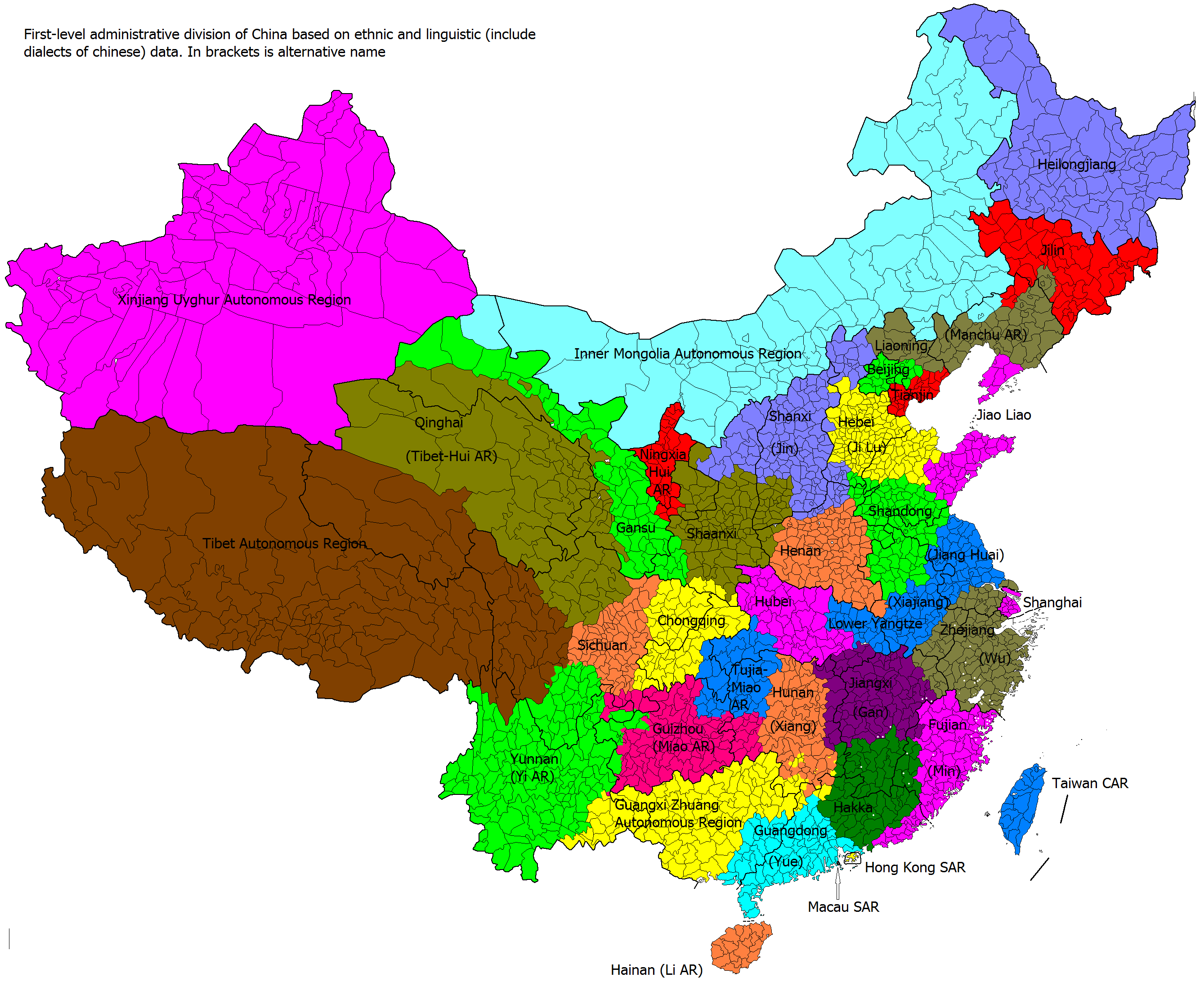
Image: Ethno-linguistic based administrative division map of China
Description: Comparison of administrative divisions of People's Republic of China, its dependencies, and Chinese Taipei (Taiwan) with actual ethno-linguistic distribution. Colors show how administrative divisions would look like, if they were based on ethno-linguistic distribution; thicker black borders show actual administrative division. 中文(简体): 中国县级政区地图,按民族、语言和地域上色
Title: Ethno-linguistic based administrative division map of China
Credit: Own work
Author: Kaiyr, based on https://www.nytimes.com/interactive/2009/07/10/world/20090711-xinjiang.html?_r=1& , http://www.muturzikin.com/cartesasie/9.htm , http://www.360doc.com/content/12/0813/22/276037_230028707.shtml , http://www.pai-hang-bang.com/tupian/中国少族民族分布图.html , http://www.zxxk.com/article/329123.html , File:Autonomous rule divisions in China.png, en:Ethnic townships of the People's Republic of China
Usage Terms: Creative Commons Attribution-Share Alike 3.0
License: CC BY-SA 3.0
License Link: https://creativecommons.org/licenses/by-sa/3.0
Attribution Required?: Yes
Image usage
The following page links to this image:
