
Image: Europe land use map
Size of this preview: 800 × 590 pixels. Other resolutions: 320 × 236 pixels | 1,004 × 740 pixels.
Original image (1,004 × 740 pixels, file size: 640 KB, MIME type: image/png)
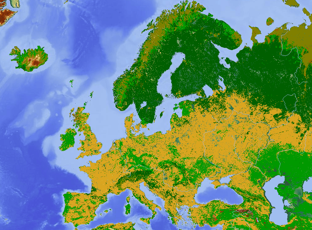
Description: A map of land use in Europe. Yellow: cropland and arable, light green: grassland and pasture, dark green: forest, light brown: tundra or bogs, unshaded areas: other (including towns and cities). Underlying map is a terrain map.
Title: Europe land use map
Credit: Created from http://www.maps-for-free.com/
Author: Kentynet (talk) 10:12, 30 April 2011 (UTC)
Usage Terms: GNU Free Documentation License
License: GFDL
License Link: http://www.gnu.org/copyleft/fdl.html
Attribution Required?: Yes
Image usage
The following page links to this image:

All content from Kiddle encyclopedia articles (including the article images and facts) can be freely used under Attribution-ShareAlike license, unless stated otherwise.