
Image: European Union relief laea location map

Size of this PNG preview of this SVG file: 701 × 599 pixels. Other resolution: 281 × 240 pixels.
Original image (SVG file, nominally 1,401 × 1,198 pixels, file size: 1,018 KB)
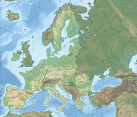
Description: Topographic map of Europe with European Union highlighted Projection: LAEA Europe, EPSG:3035 Longitude of projection center: 10° E Latitude of projection center: 52° N Map extent (LAEA Europe) Xmin,Ymin to Xmax, Ymax: 2555000, 1350000 to 7405000, 5500000 Map extent (WGS84) (lon,lat of lower left and upper right corner): -8.9067, 33.2307 to 72.9617, 58.9174
Title: European Union relief laea location map
Credit: Europe relief laea location map.jpg
Author: Europe relief laea location map.jpg: Alexrk2 derivative work: Pethrus
Usage Terms: Creative Commons Attribution-Share Alike 3.0
License: CC BY-SA 3.0
License Link: https://creativecommons.org/licenses/by-sa/3.0
Attribution Required?: Yes
Image usage
The following page links to this image:

All content from Kiddle encyclopedia articles (including the article images and facts) can be freely used under Attribution-ShareAlike license, unless stated otherwise.