
Image: Ewald BoundBrook 1777

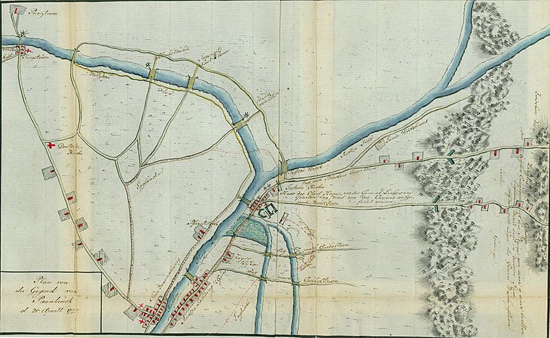
Description: The map shows the four routes of the April 13, 1777 attack on Bound Brook, the Battle of Bound Brook. New Brunswick is located in the lower left, across from Raritan Landing. The house of the Reverend Abraham Beach ("Pfar Ritsche"), pastor of Christ Church in New Brunswick is along the Raritan River. Bound Brook and the Van Veghten Bridge are in the center. The inscriptions read: "German Church" and "House of Colonel Horne, where the quarters of General Lincoln were situated, and where the cannon were mounted." Philip Van Horne's house was known as Phil's Hill or Convivial Hill. The approaches to Washington's first winter encampment at Morristown, with the barriers in the First Watchung Mountains, are shown at the extreme right. The inscription reads: "Between these two mountains in this valley is a plain one and a half English miles in the breadth, in front of the rest camp of General Washington." (Notes: Plan of the Area of Bound Brook)
Title: Ewald BoundBrook 1777
Credit: Keystone Library Network Digital Collections / Bloomsburg University map059.jpg
Author: Johann von Ewald
Usage Terms: Public domain
License: Public domain
Attribution Required?: No
Image usage
The following 2 pages link to this image:
