
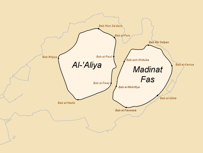
Image: Fes walls history 1 - early 11th century (pre-Almoravid)

Description: Map 1 of 5, showing Fes in the early 11th century, before the unification of its two settlements by the Almoravids in 1069. This is ultimately based on a proposed reconstitution of the early settlements by Évariste Lévi-Provençal (included in source below; a similar map by Henri Gaillard is also included). The outlines of the walls are approximate and might be better interpreted as a schematic representation of the two cities. Map based on minor updates to "Murailles de Fès - fin Xe siècle.PNG" by Omar-toons. Removed Borj Nord outline for simplicity, and otherwise just small adjustments to name spellings to be consistent with the main source maps in: Le Tourneau, Roger (1949). "Fès avant le protectorat: étude économique et sociale d'une ville de l'occident musulman". p. 42-43. (A copy of these maps can be accessed in a UNESCO report here, on page 4 and after: https://unesdoc.unesco.org/ark:/48223/pf0000039605?posInSet=17&queryId=N-EXPLORE-cad3fb24-479f-4d70-bac6-6a01dc836092 )
Title: Fes walls history 1 - early 11th century (pre-Almoravid)
Credit: Wiki Commons
Author: Base map: Omar-toons Major modifications: R Prazeres
Usage Terms: Creative Commons Attribution-Share Alike 4.0
License: CC BY-SA 4.0
License Link: https://creativecommons.org/licenses/by-sa/4.0
Attribution Required?: Yes
Image usage
The following page links to this image:

.png)