
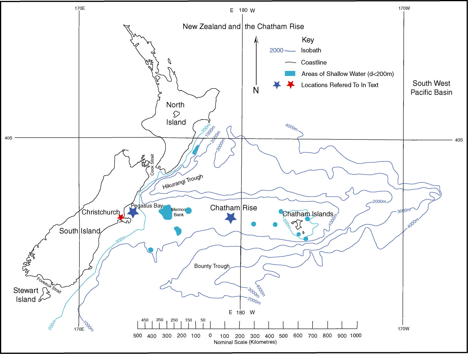
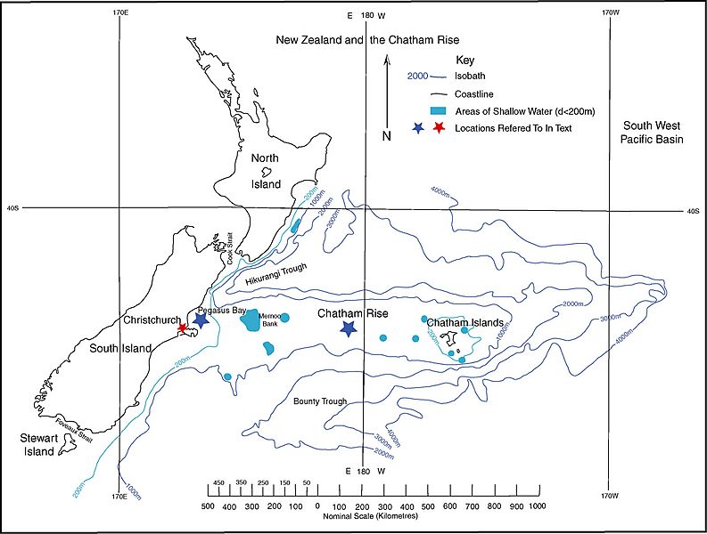
Image: Fig 1 Chatham Rise Map
Size of this preview: 793 × 600 pixels. Other resolutions: 318 × 240 pixels | 1,578 × 1,193 pixels.
Original image (1,578 × 1,193 pixels, file size: 210 KB, MIME type: image/jpeg)
Description: A map of the Chatham Rise, a submarine feature, which extends 1300km eastward of Christchurch, New Zealand
Title: Fig 1 Chatham Rise Map
Credit: Own work
Author: Ngatimozart
Usage Terms: Creative Commons Zero, Public Domain Dedication
License: CC0
License Link: http://creativecommons.org/publicdomain/zero/1.0/deed.en
Attribution Required?: No
Image usage
The following page links to this image:

All content from Kiddle encyclopedia articles (including the article images and facts) can be freely used under Attribution-ShareAlike license, unless stated otherwise.