
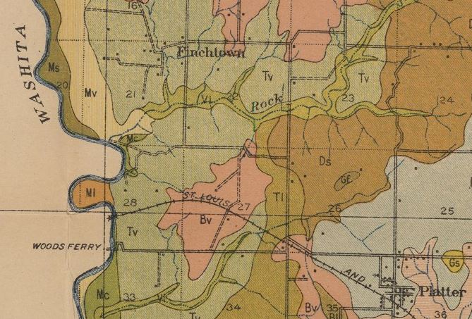
Image: Finchtown
No higher resolution available.
Finchtown.JPG (669 × 453 pixels, file size: 92 KB, MIME type: image/jpeg)
Description: This is a closeup of a map showing the location of Finchtown, Oklahoma and its proximity to Platter, Oklahoma.
Title: Finchtown
Credit: Soil Map, Oklahoma, Bryan County Sheet
Author: U.S. Department of Agriculture Bureau of Soils, Milton Whitney, Chief, Curtis F. Marbut, in charge of soil survey; soils surveyed by William T. Carter, Jr. and A.L. Patrick; map engraved by Snyder & Black of New York.
Permission: The map was published in the United States prior to 1923 and is thus in the public domain.
Usage Terms: Public domain in the United States
License: PD-US
License Link: //en.wikipedia.org/wiki/File:Finchtown.JPG
Image usage
The following page links to this image:

All content from Kiddle encyclopedia articles (including the article images and facts) can be freely used under Attribution-ShareAlike license, unless stated otherwise.