
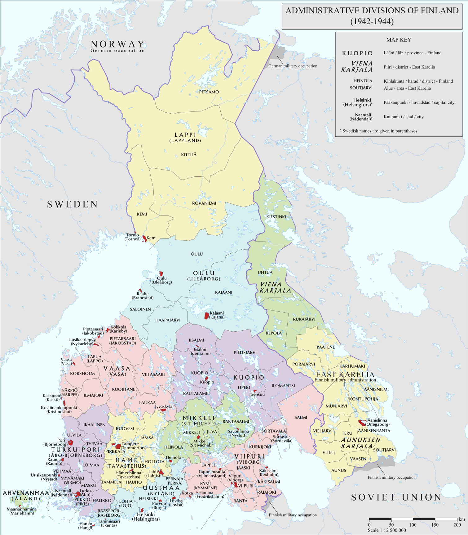
Image: Finland Administrative map 1942 1944
Description: Administrative divisions of Finland in 1942-1944
Title: Finland Administrative map 1942 1944
Credit: Statistical map of Finland in 1947: https://commons.wikimedia.org/wiki/File:Suomi,_tilastokartta_1947.jpg Statistical map of Finland in 1935: https://commons.wikimedia.org/wiki/File:Suomi,_tilastokartta_1935.jpg Finnish statistical yearbooks 1942-1945: http://www.doria.fi/search?query=stv+1942&submit=Hae Various Finnish topographic and general maps from koti.kapsi.fi (http://koti.kapsi.fi/~timomeriluoto/KARTAT/) and from the Digital Archives of the National Archives of Finland (http://digi.narc.fi/digi/) For the subdivisions of Eastern Karelia: Itä-Karjalan sotilashallintoalue 1942 - Osmo Hyytiä, "Helmi Suomen maakuntien joukossa". Suomalainen Itä-Karjala 1941-1944, pg. 356 (map found on https://helda.helsinki.fi/bitstream/handle/10138/20137/kasityot.pdf?sequence=1, pg. 121)
Author: Andrein
Usage Terms: Creative Commons Attribution-Share Alike 4.0
License: CC BY-SA 4.0
License Link: http://creativecommons.org/licenses/by-sa/4.0
Attribution Required?: Yes
Image usage
The following page links to this image:
