
Image: FinnishCivilWarMapBegin

Size of this PNG preview of this SVG file: 401 × 600 pixels. Other resolution: 160 × 240 pixels.
Original image (SVG file, nominally 611 × 914 pixels, file size: 459 KB)
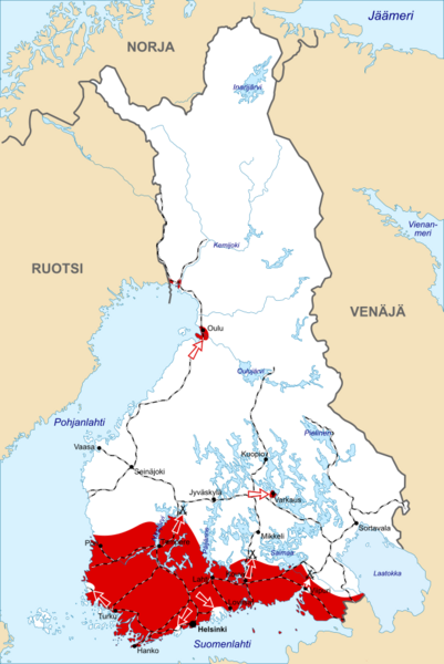
Description: Initial front lines and offensives of the Civil War at the beginning of February, 1918. Area controlled by the Finnish government ("Whites") in white, and by the Finnish rebellions ("Reds") in red. The black lines show the Finnish railroad network at the time.
Title: FinnishCivilWarMapBegin
Credit: Based on en:Image:FinnishCivilWarMapBegin.jpg. Base map of Finland: Image:Finland 1918 plain.png.
Author: Original map of the War: Ville Virrankoski. Base map of Finland in 1918: Jniemenmaa
Usage Terms: Creative Commons Attribution-Share Alike 3.0
License: CC BY-SA 3.0
License Link: http://creativecommons.org/licenses/by-sa/3.0/
Attribution Required?: Yes
Image usage
The following page links to this image:

All content from Kiddle encyclopedia articles (including the article images and facts) can be freely used under Attribution-ShareAlike license, unless stated otherwise.