
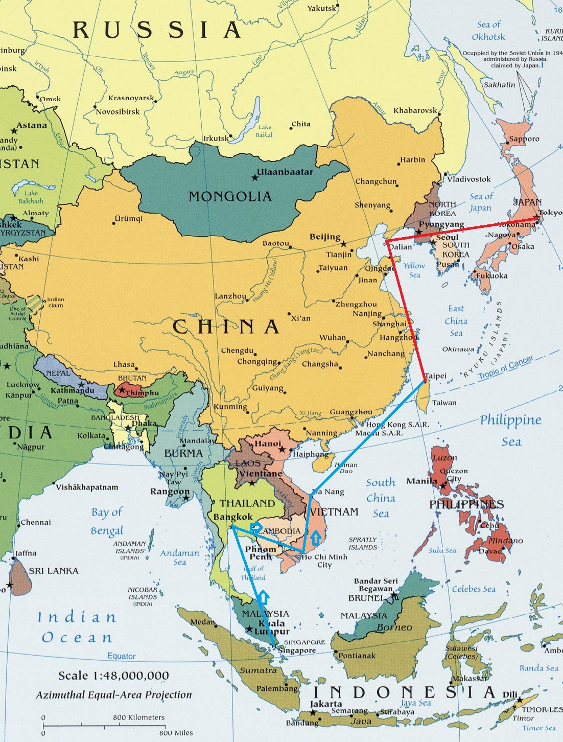
Image: Flight paths of Subhas Chandra Bose on 16, 17, and 18 August 1945
Description: Map of Asia at the UT-Carlos-Castenada Libaray, cropped and annotated by Fowler&fowler (talk) 05:41, 14 November 2013 (UTC) to show the last journeys of Indian nationalist Subhas Chandra Bose, between 16 August 1945 and 18 August 1945. The paths of completed flights are shown in blue, those not completed in red. Bose's plane crashed in Taihoku (now Taipei, Taiwan). Bose was to have disembarked in Dairen, Manchuria (now Dalian China) on the Manchurian peninsula, and the plane was to have continued on to Tokyo.
Title: Flight paths of Subhas Chandra Bose on 16, 17, and 18 August 1945
Credit: http://www.lib.utexas.edu/maps/middle_east_and_asia/txu-oclc-247232986-asia_pol_2008.jpg
Author: US-Central Intelligence Agency. Annotated by Fowler&fowler (talk) 05:41, 14 November 2013 (UTC) to show the last flights of Subhas Chandra Bose
Permission: This image is a work of a Central Intelligence Agency employee, taken or made as part of that person's official duties. As a Work of the United States Government, this image or media is in the public domain in the United States. Български | Čeština | Deutsch | English | Español | Eesti | Suomi | Italiano | 日本語 | 한국어 | Македонски | മലയാളം | Polski | Português | Русский | Sicilianu | Slovenščina | Українська | 中文 | 中文(简体) | +/−
Usage Terms: Public domain
License: Public domain
Attribution Required?: No
Image usage
The following 2 pages link to this image:
