
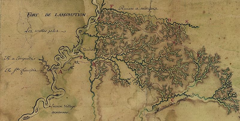
Image: Fort De Lassomption Memphis TN LoC map

Description: Detail of a French map depicting what today is the Memphis, Tennessee area. "This map of the Mississippi River Valley from Memphis to the Gulf of Mexico as far east as Mobile includes interior streams, routes, European communities, and Native American settlements and nations, fortifications ... Map concentrates on the surveys of Broutin, Vergés, and Saucier in Mississippi and Alabama ..." Map is a digital copy from the U.S. Library of Congress.
Title: Fort De Lassomption Memphis TN LoC map
Credit: http://hdl.loc.gov/loc.gmd/g4010.ct000681
Author: Louisiana and Mississippi routes of Broutin, de Verges, and Saucier, author unknown.
Permission: This image might not be in the public domain outside of the United States; this especially applies in the countries and areas that do not apply the rule of the shorter term for US works, such as Canada, Mainland China (not Hong Kong or Macao), Germany, Mexico, and Switzerland. The creator and year of publication are essential information and must be provided. See Wikipedia:Public domain and Wikipedia:Copyrights for more details.
Usage Terms: Public domain
License: Public domain
Attribution Required?: No
Image usage
The following page links to this image:
