
Image: Fort Malden map, enhanced
Size of this preview: 337 × 599 pixels. Other resolutions: 135 × 240 pixels | 1,900 × 3,378 pixels.
Original image (1,900 × 3,378 pixels, file size: 1.47 MB, MIME type: image/jpeg)
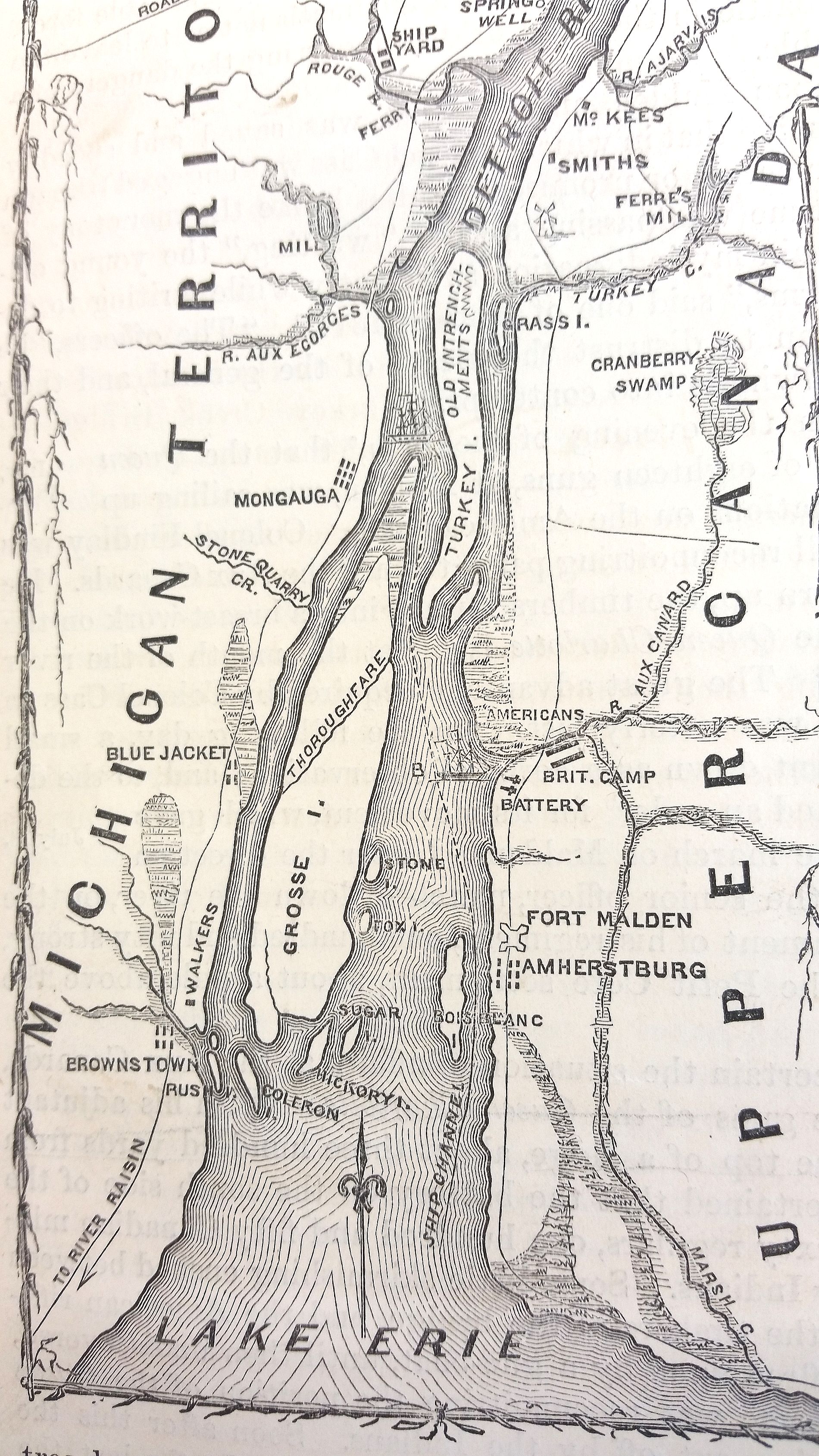
Description: Map of Fort Malden and other points of interest on Detroit River, during the War of 1812
Title: Fort Malden map, enhanced
Credit: Enhanced version of existing file File:Fort Malden.jpg - brighter image, better color tone
Author: The Pictorial Field Book of the War of 1812
Usage Terms: Public domain
License: Public domain
Attribution Required?: No
Image usage
The following page links to this image:

All content from Kiddle encyclopedia articles (including the article images and facts) can be freely used under Attribution-ShareAlike license, unless stated otherwise.