
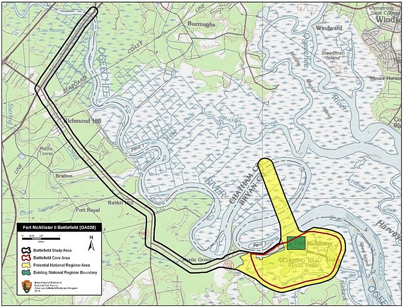
Image: Fort McAllister II Battlefield Georgia

Size of this preview: 784 × 600 pixels. Other resolutions: 314 × 240 pixels | 1,830 × 1,400 pixels.
Original image (1,830 × 1,400 pixels, file size: 887 KB, MIME type: image/jpeg)
Description: Map of battlefield core and study areas. The boundaries include: the Federal approach route from King's Bridge beginning where Federal forces crossed the Ogeechee River to begin their assault on the fort; the viewshed between Sherman’s observation post at Cheves Plantation, from which he signaled for the attack to begin, and Fort McAllister; the area of engagement.
Title: Fort McAllister II Battlefield Georgia
Credit: National Park Service
Author: American Battlefield Protection Program
Usage Terms: Public domain
License: Public domain
Attribution Required?: No
Image usage
The following page links to this image:

All content from Kiddle encyclopedia articles (including the article images and facts) can be freely used under Attribution-ShareAlike license, unless stated otherwise.