
Image: Fort Wagner. Morris Island LOC gvhs01.vhs00230

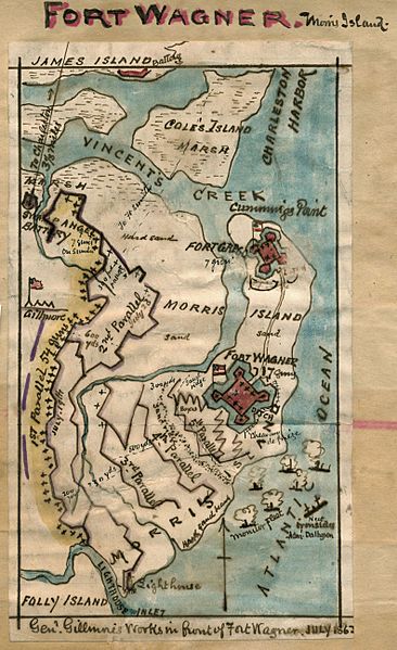
Description: In July 1863, Union Generals Gillmore and Dahlgren hoped to take Fort Wagner, on Morris Island in Charleston Harbor, in order to gain a vantage point from which to launch an attack on the city of Charleston. Strongly defended, the first Union assaults (July 10th and 18th) resulted in extremely high casualties. Gillmore began formal siege operations and had reached to base of the fort by September 6th. The Confederate forces abandoned the fort during the night. This map includes Folly Island to the south of Morris Island, Charleston Harbor to the northeast and Coles Island to the north.
Title: Fort Wagner. Morris Island LOC gvhs01.vhs00230
Credit: https://www.loc.gov/item/gvhs01.vhs00230/
Author: Sneden, Robert Knox
Permission: This map is available from the United States Library of Congress's Geography & Map Division under the digital ID gvhs01.vhs00230. This tag does not indicate the copyright status of the attached work. A normal copyright tag is still required. See Commons:Licensing for more information.
Usage Terms: Public domain
License: Public domain
Attribution Required?: No
Image usage
The following page links to this image:
