
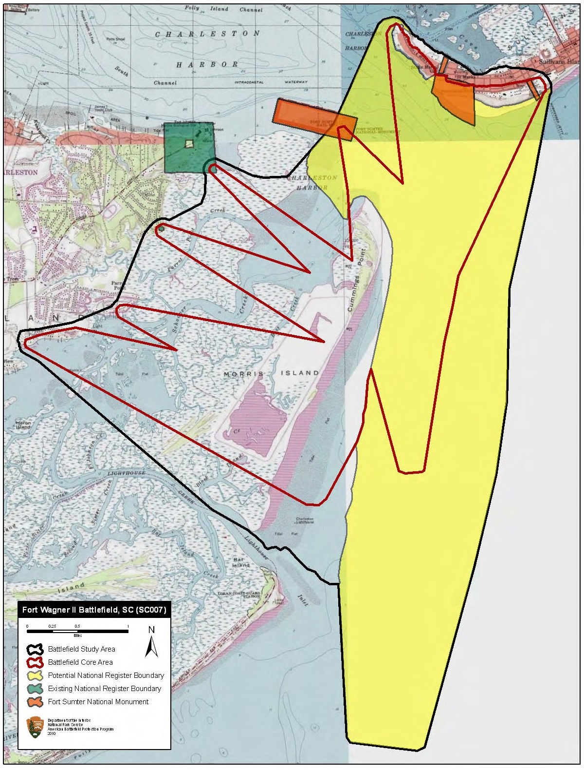
Image: Fort Wagner II Battlefield South Carolina
Description: Map of battlefield core and study areas. The ABPP realigned the 1993 Study Area boundary to reflect the coastline of Morris Island as it was in 1863, and to include the locations of Confederate batteries on the southern edge of James Island. To represent the full extent of regional fighting during this battle, the ABPP also added the locations of Fort Sumter, Fort Bee, Fort Moultrie, and Fort Beauregard. The Core Area was revised to represent the firing patterns of Fort Sumter and the Confederate batteries on James Island (batteries Ryan, Tatom, Haskell, Cheves, and Simkins) in response to Federal siege operations on Morris Island. Additional Core Area modifications illustrate the fields of fire associated with Fort Bee, Fort Moultrie, and Fort Beauregard against US naval forces supporting the assault on Fort Wagner and Battery Gregg.
Title: Fort Wagner II Battlefield South Carolina
Credit: National Park Service
Author: American Battlefield Protection Program
Usage Terms: Public domain
License: Public domain
Attribution Required?: No
Image usage
The following page links to this image:
