
Image: Fort Wagner I Battlefield South Carolina

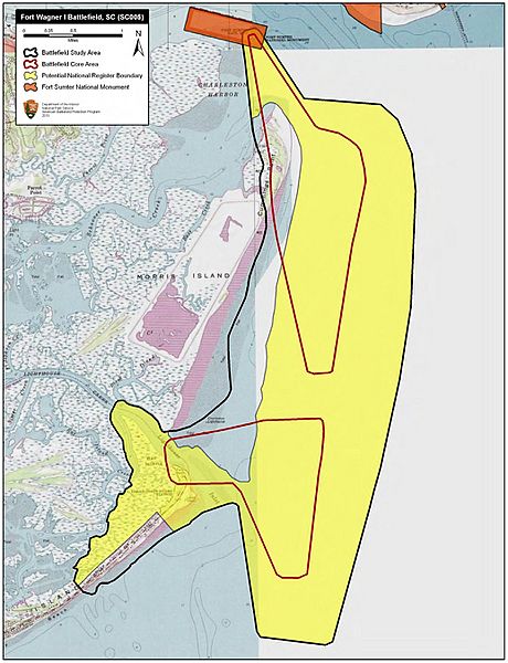
Description: Map of battlefield core and study areas. The ABPP revised the 1993 Study Area to reflect the coastline of Morris Island as it was shaped in 1863. The revised Study Area also includes the main shipping channel of Charleston Harbor and Light House Inlet (both used by attacking US Naval forces), the Folly Island camps and batteries, and the angled field of fire from Fort Sumter. The ABPP modified the northern Core Area to represent the ranges of heavy artillery fire from US vessels in the harbor, and from Fort Wagner and Fort Sumter. The southern Core Area includes the field of covering fire from US Army batteries along the northern edge of Folly Island, and fields of fire associated with US Navy vessels in the harbor channel and ships landed with BG Strong's Brigade on the southern tip of Morris Island.
Title: Fort Wagner I Battlefield South Carolina
Credit: National Park Service
Author: American Battlefield Protection Program
Usage Terms: Public domain
License: Public domain
Attribution Required?: No
Image usage
The following page links to this image:
