
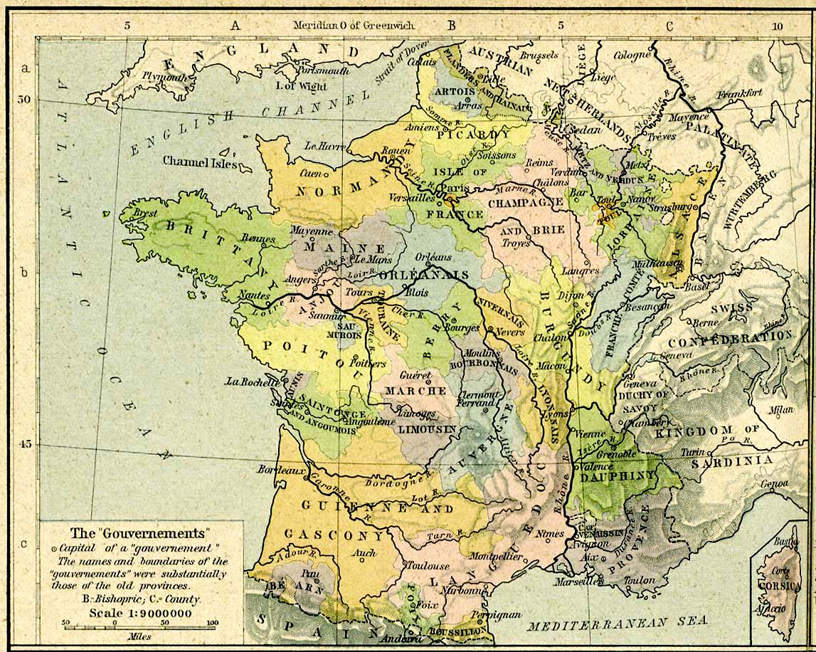
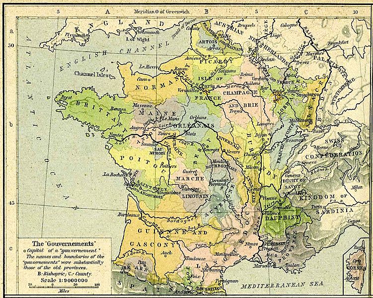
Image: France anciennes provinces 1789
Size of this preview: 751 × 600 pixels. Other resolutions: 301 × 240 pixels | 1,147 × 916 pixels.
Original image (1,147 × 916 pixels, file size: 343 KB, MIME type: image/jpeg)
Description: Carte des anciens gouvernements français en 1789 in The Historical Atlas by William R. Shepherd, 1926 (Les provinces ont des frontières différentes)
Title: France anciennes provinces 1789
Usage Terms: Public domain
License: Public domain
Attribution Required?: No
Image usage
There are no pages that link to this image.

All content from Kiddle encyclopedia articles (including the article images and facts) can be freely used under Attribution-ShareAlike license, unless stated otherwise.