
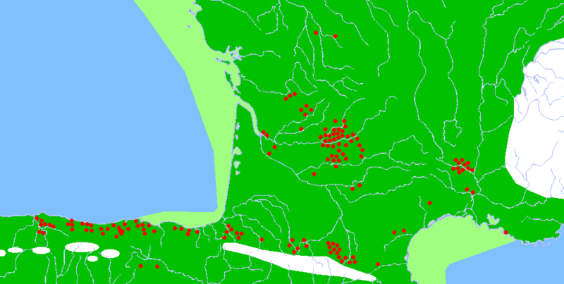
Image: Franco-Cantabrian region

Description: Description: Map of the Franco-Cantabrian archaeological region (Upper Paleolithic), showing: Main caves with mural art (red dots) Approximate extension of permanent ice (white) Approximate extension of now submerged lands (light green)
Title: Franco-Cantabrian region
Credit: French map of the Ministry of Culture 1984, published online here Map of Upper Paleolithic Europe here A. Moure, El origen del hombre. Historia 16, 1999. ISBN 84-7679-127-5 F. Jordá et al., Historia de España 1. Prehistoria. Gredos, 1989. ISBN 84-249-1015-X X. Peñalver, Euskal Herria en la Prehistoria. Orain, 1996. ISBN 84-89077-58-4
Author: en:User:Sugaar Original uploader was Sugaar at en.wikipedia, description page is/was here.
Permission: Released into the public domain (by the author).
Usage Terms: Public domain
License: Public domain
Attribution Required?: No
Image usage
The following 2 pages link to this image:
