
Image: Franklin Leavitt map 1871
No higher resolution available.
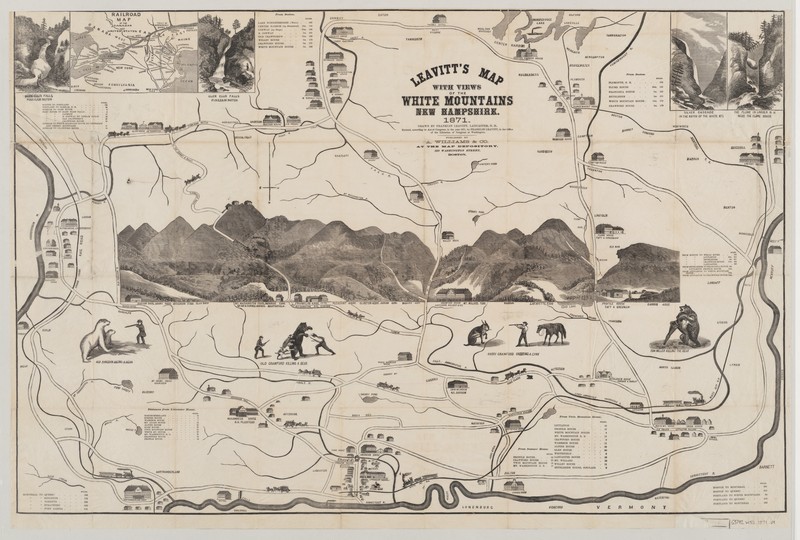
Franklin_Leavitt_map_1871.jpg (800 × 540 pixels, file size: 140 KB, MIME type: image/jpeg)
Description: The fourth of artist Franklin Leavitt's maps of the White Mountains, the 1871 map was also the largest. It was engraved on wood by Samuel E. Brown of Boston, printed by A. Williams and Co., and carried a retail price of $1.00. The map has the most realistic depiction of the mountains which make up the Whites of all Leavitt's maps of the range.
Title: Franklin Leavitt map 1871
Credit: http://whitemountainhistory.org/1871_Franklin_Leavitt_Map.html
Author: Franklin Leavitt, Samuel E. Brown, A. Williams & Co.
Usage Terms: Public domain
License: Public domain
Attribution Required?: No
Image usage
The following page links to this image:

All content from Kiddle encyclopedia articles (including the article images and facts) can be freely used under Attribution-ShareAlike license, unless stated otherwise.