
Image: Fredericktown Battlefield Missouri
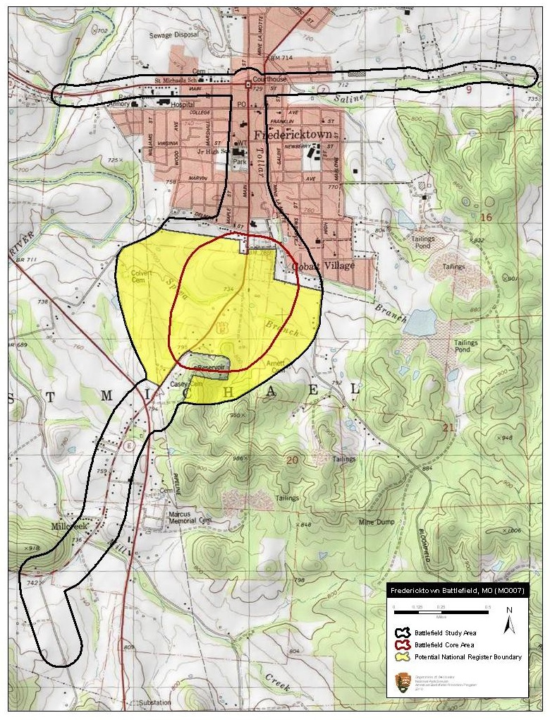
Description: Map of battlefield core and study areas. The 1993 Study Area was revised to include the routes of approach used by the two columns of Union troops (one from Cape Girardeau and the other from Pilot Knob) converging to the north of the town of Fredericktown. The ABPP also included the route taken by the retreating Confederate and pursuing Federal troops to the south. The Study Area was enlarged around the Core Area to the west to include the area where the Union line wheeled against Thompson’s force in the cornfield opposite the Union left.
Title: Fredericktown Battlefield Missouri
Credit: National Park Service
Author: American Battlefield Protection Program
Usage Terms: Public domain
License: Public domain
Attribution Required?: No
Image usage
The following page links to this image:
