
Image: Freeman's Marsh - geograph.org.uk - 842229
No higher resolution available.
Freeman's_Marsh_-_geograph.org.uk_-_842229.jpg (640 × 480 pixels, file size: 80 KB, MIME type: image/jpeg)
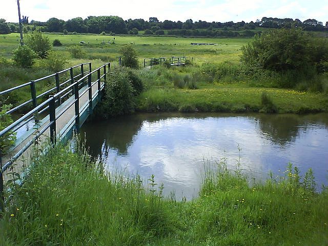
Description: Freeman's Marsh A footpath runs past Hopgrass Farm and over these footbridges onto Freeman's Marsh, an ancient common to the west of Hungerford. Three east-west features pass through the marsh. The River Dun is in the foreground, the Kennet and Avon Canal can just be made out in the middle and the railway runs along the first line of trees.
Title: Freeman's Marsh - geograph.org.uk - 842229
Credit: From geograph.org.uk
Author: Graham Horn
Usage Terms: Creative Commons Attribution-Share Alike 2.0
License: CC BY-SA 2.0
License Link: https://creativecommons.org/licenses/by-sa/2.0
Attribution Required?: Yes
Image usage
The following page links to this image:

All content from Kiddle encyclopedia articles (including the article images and facts) can be freely used under Attribution-ShareAlike license, unless stated otherwise.