
Image: Frezier Voyage Amerique
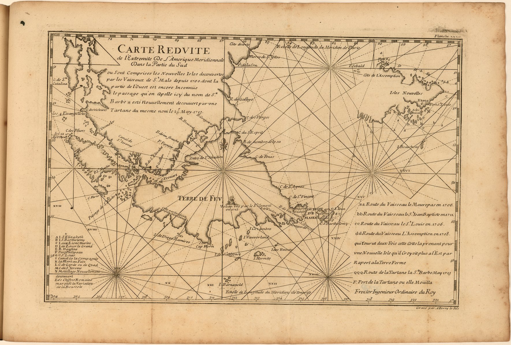
Description: Fold-out, engraved map of the Strait of Magellan or Estrecho de Magellanes and the Le Maire Strait or Estrecho de le Maire. Includes locations of rivers, shoals, and settlements. Includes the routes taken by ships in the early 18th century (Maurepas in 1706, the Saint Jean Baptiste in 1711, the Satin Luis in 1706, Assomption in 1708 and the Tartane or Staine Barbe in 1713). Keys identifiy locations on map and routes taken by ships.
Title: Frezier Voyage Amerique
Credit: A voyage to the South-sea, and along the coasts of Chili and Peru, in the years 1712, 1713, and 1714. London: 1717. https://jcb.lunaimaging.com/luna/servlet/view/search/when/1717?q=E717+F896v&sort=normalized_date%2Cfile_name%2Csource_author%2Csource_title
Author: Amédée François Frézier
Usage Terms: Public domain
License: Public domain
Attribution Required?: No
Image usage
The following page links to this image:
