
Image: Frezier Voyage Plan St. Vincent
Size of this preview: 419 × 600 pixels. Other resolutions: 167 × 240 pixels | 1,673 × 2,395 pixels.
Original image (1,673 × 2,395 pixels, file size: 993 KB, MIME type: image/jpeg)
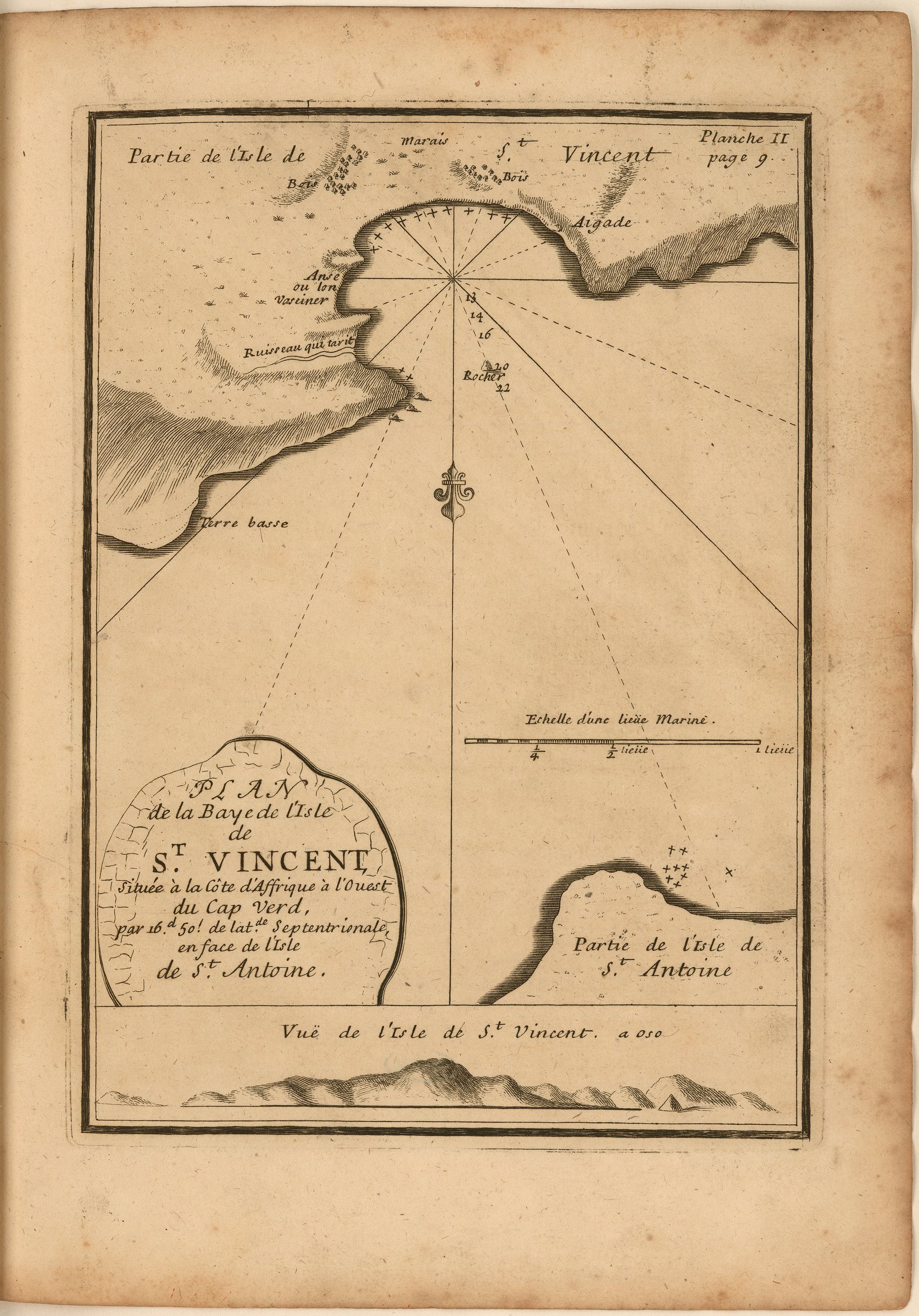
Description: Engraved map of the bay on the island of St. Vincent, present-day São Vicente, of the Barlavento islands of Cape Verde. Includes part of Santo Antão island. Includes soundings, indications of dangerous rocks, location of dwellings, and a profile of the island.
Title: Frezier Voyage Plan St. Vincent
Credit: A voyage to the South-sea, and along the coasts of Chili and Peru, in the years 1712, 1713, and 1714. London: 1717. https://jcb.lunaimaging.com/luna/servlet/view/search/when/1717?q=E717+F896v&sort=normalized_date%2Cfile_name%2Csource_author%2Csource_title
Author: Amédée François Frézier
Usage Terms: Public domain
License: Public domain
Attribution Required?: No
Image usage
The following page links to this image:

All content from Kiddle encyclopedia articles (including the article images and facts) can be freely used under Attribution-ShareAlike license, unless stated otherwise.