
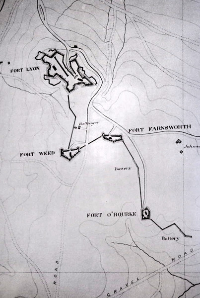
Image: Ft. Lyon sector map
Size of this JPG preview of this TIF file: 403 × 599 pixels. Other resolution: 161 × 240 pixels.
Original image (636 × 945 pixels, file size: 1.73 MB, MIME type: image/tiff)
Description: Map of the Defenses of Washington between Ft. Lyon and Ft. O'Rourke
Title: Ft. Lyon sector map
Credit: Cooling III, Benjamin Franklin & Owen II, Walton H. (1988). Mr. Lincoln's Forts: A Guide to the Civil War Defenses of Washington. Shippensburg, Pennsylvania: White Mane Publishing. ISBN 0-942597-06-0. p. 54
Author: Unknown US Army engineer
Permission: This image is a work of a U.S. Army soldier or employee, taken or made as part of that person's official duties. As a work of the U.S. federal government, the image is in the public domain.
Usage Terms: Public domain
License: Public domain
Attribution Required?: No
Image usage
The following page links to this image:

All content from Kiddle encyclopedia articles (including the article images and facts) can be freely used under Attribution-ShareAlike license, unless stated otherwise.