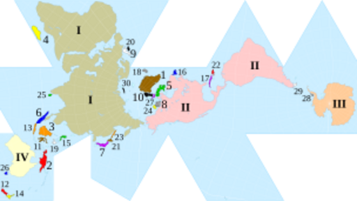
Image: Fuller projection with largest islands

Size of this PNG preview of this SVG file: 512 × 288 pixels. Other resolution: 320 × 180 pixels.
Original image (SVG file, nominally 512 × 288 pixels, file size: 554 KB)
Description: Dymaxion map of the world with the continental landmasses (Roman numerals) and 30 largest islands (Hindu-Arabic numerals) highlighted. (The list stops at 30 as the next few islands are north of Canada, and space is insufficient for their labels.)
Title: Fuller projection with largest islands
Credit: Dymaxion with Tissot's Indicatrices of Distortion.svg
Author: cmglee, Justin Kunimune
Usage Terms: Creative Commons Attribution-Share Alike 4.0
License: CC BY-SA 4.0
License Link: https://creativecommons.org/licenses/by-sa/4.0
Attribution Required?: Yes
Image usage
The following 2 pages link to this image:

All content from Kiddle encyclopedia articles (including the article images and facts) can be freely used under Attribution-ShareAlike license, unless stated otherwise.
