
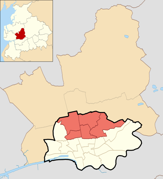
Image: Fulwood in City of Preston wards 2010

Size of this PNG preview of this SVG file: 545 × 599 pixels. Other resolution: 218 × 240 pixels.
Original image (SVG file, nominally 1,187 × 1,305 pixels, file size: 327 KB)
Description: Fulwood shown with the electoral wards of the City of Preston, Lancashire, England Equirectangular map projection on WGS 84 datum, with N/S stretched 165% Geographic limits: West: 2.83W East: 2.59W North: 53.90N South: 53.74N
Title: Fulwood in City of Preston wards 2010
Credit: File:Preston_UK_ward_map_2010_(blank).svg
Author: File:Preston_UK_ward_map_2010_(blank).svg: Nilfanion derivative work: Dr Greg
Usage Terms: Creative Commons Attribution-Share Alike 3.0
License: CC BY-SA 3.0
License Link: http://creativecommons.org/licenses/by-sa/3.0
Attribution Required?: Yes
Image usage
There are no pages that link to this image.

All content from Kiddle encyclopedia articles (including the article images and facts) can be freely used under Attribution-ShareAlike license, unless stated otherwise.