
Image: Furber, Haynes, & Stillman Plan of Matamoras, and Vicinity 1847-1848 UTA

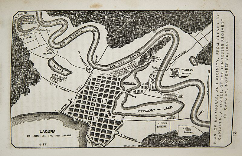
Description: The plan depicts the city in November 1846 during the U.S. occupation. The camp of Furber's unit, the First Regiment of Tennessee Volunteers, may be seen along the river in the northwest (upper left) portion of the map. He also shows the camps of U.S. regulars as well as Illinois, Ohio, and Indiana regiments. Furber acknowledged a survey by Tennessee Mounted Volunteer Regiment Captain Milton A. Haynes (1814-1867), a West Point graduate, as the base for the map. Furber's accompanying narrative (pp. 188-241) includes an excellent description of the city, its fortifications, its inhabitants, and the vicinity around it in addition to details of camp life.
Title: Plan of Matamoras, and vicinity, from survey by captain M.A. Haynes, of the Tennessee regiment of cavalry, November 30, 1847.
Credit: UTA Libraries A Continent Divided
Author: George C. Furber Milton Andrew Haynes Stillman
Usage Terms: Public domain
License: Public domain
Attribution Required?: No
Image usage
The following page links to this image:
