
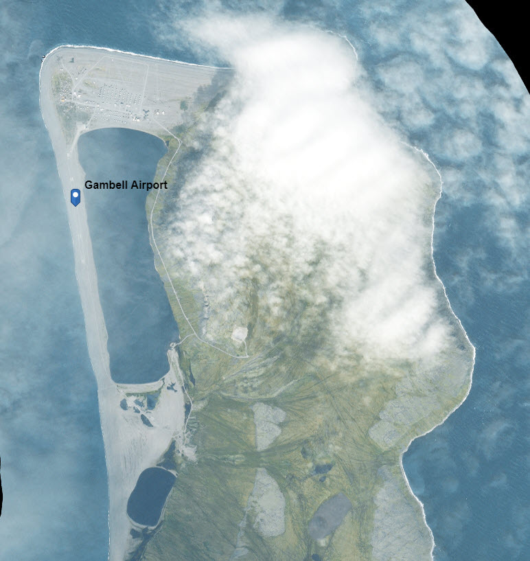
Image: Gambell Airport Alaska NAIP image
Size of this preview: 566 × 599 pixels. Other resolutions: 227 × 240 pixels | 772 × 817 pixels.
Original image (772 × 817 pixels, file size: 101 KB, MIME type: image/jpeg)
Description: Satellite view of Gambell Airport in Alaska, using the National Map NAIP overlay
Title: Gambell Airport Alaska NAIP image
Credit: National Map, using the NAIP overlay, https://viewer.nationalmap.gov/advanced-viewer/viewer/index.html?marker=-171.732778%2C63.766667%2C4326%2Cfrom%20Gambell_Airport%2C%2CGambell%20Airport&scale=30000&extent=-19122708.8655%2C9287738.4236%2C-19104363.9787%2C9296614.6735%2C102100
Author: US Gov't
Usage Terms: Public domain
License: Public domain
Attribution Required?: No
Image usage
The following page links to this image:

All content from Kiddle encyclopedia articles (including the article images and facts) can be freely used under Attribution-ShareAlike license, unless stated otherwise.