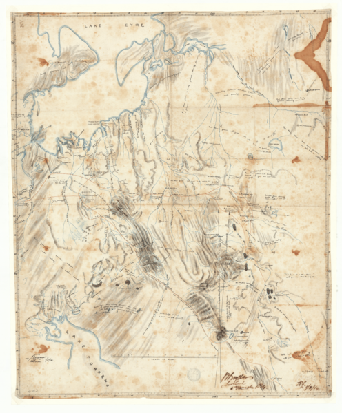
Image: George Goyder's manuscript map of Lake Torrens - Lake Eyre region, South Australia, 1864 (SLSA B 1901011)

Description: George Goyder's manuscript map of the area between Lake Torrens and Lake Eyre, South Australia. Includes detailed notes on natural features and shows the tracks of explorer Edward John Eyre. From the State Library's notes: Goyder described and promoted the method that he used to produce this map to the South Australian Parliament in 1864: "This mode of survey has been so successfully adopted by me, and the information obtained whilst crossing from station to station for the purpose of observation and examining the country to obtain water for the supply of the party has been so ample, that I have been enabled to construct a map embracing 150,000 square miles of country during a two month's journey, which showed discrepancy of not more than a mile between the extreme stations, a hundred and twenty miles apart, when compared with the trigonometrical survey of the same locality, which, from the scarcity of water and other causes, required nine additional months to complete." -- South Australian Parliamentary Paper No. 36, 1864 'Settlement of Northern Territory' p. 14.
Title: George Goyder's manuscript map of Lake Torrens - Lake Eyre region, South Australia, 1864 (SLSA B 1901011)
Credit: State Library of South Australia -- https://www.catalog.slsa.sa.gov.au/record=b1901011
Author: George Woodroffe Goyder
Usage Terms: Public domain
License: Public domain
Attribution Required?: No
Image usage
The following page links to this image:

